
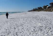
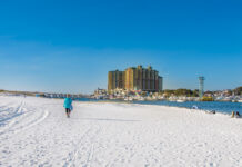
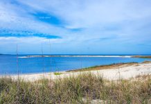
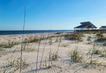
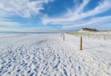
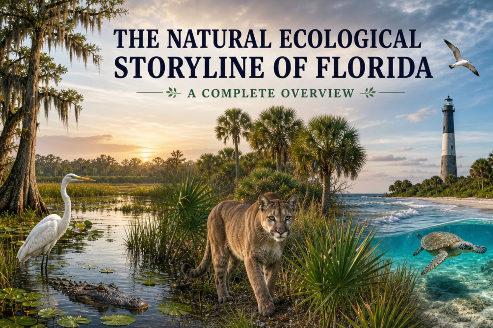
Florida is often described by its beaches.
White sand. Emerald water. Turquoise water. Palm trees. Waves. Sunsets.
But walk the entire coastline and you start to see something much more interesting.
Florida isn’t one coastal environment. It is a long, constantly changing ecological story. The sand changes. The water changes. The shoreline changes. Dunes become marsh. Marsh becomes mangrove. Rivers meet the Gulf. Springs pour into estuaries. Barrier islands bend around bays. Seagrass meadows stretch beneath shallow water. Limestone islands replace sandy beaches. Coral reefs take over the story in the south.
And then, the story begins again.
I use to think of the shoreline as a series of beaches. Now I see it as one enormous living system, with each region telling a slightly different chapter.
Florida has roughly 825 miles of sandy beaches, but its coastal environment is much larger than the beach itself. Salt marshes, estuaries, seagrass meadows, mangroves, barrier islands, tidal flats, rivers, coral reefs and offshore waters are all part of the same coastal story.
So let’s walk it.
1. Perdido Key & Perdido Bay
We begin in the far western Panhandle, where Florida’s coast has a distinctly northern Gulf character. Perdido Key is a barrier island shaped by Gulf waves, wind, shifting sand and the protected waters of Perdido Bay and Big Lagoon. Here, the story starts with dunes and beach vegetation, but you quickly discover that the Gulf side and bay side are telling two very different stories.
On the beach, look for the plants that make a dune possible in the first place. Sea oats and other coastal vegetation trap moving sand and help build the ridges that protect everything behind them. Turn toward the bay and the water becomes calmer, shallower and more estuarine. Marsh, seagrass, oysters, crabs, shrimp and young fish become increasingly important. This is the beginning of a Florida pattern you will see again and again: the beach is only the edge of a much larger ecosystem.
2. Pensacola & Santa Rosa Sound
Pensacola and Santa Rosa Island continue the barrier-island story, but here the relationship between Gulf and sound becomes especially obvious. Pensacola Beach faces the Gulf while Santa Rosa Sound creates a protected waterway behind the island. Fort Pickens adds another layer, with maritime habitat, dunes and historic human occupation woven into the landscape.
The sand here is part of a larger system of barrier-island movement. Wind moves it inland, waves move it alongshore, plants catch it and storms rearrange it. Behind the beach, the sound provides quieter habitat for fish, birds and other estuarine wildlife. The Panhandle’s coastal landscape is particularly rich in barrier islands, bays, marshes and protected waters, with numerous state parks and aquatic preserves helping protect those connections.
3. Navarre & Santa Rosa Island
Navarre and the long sweep of Santa Rosa Island feel like classic Gulf beach country, but the ecology is still being written by the same forces: sand, wind, waves and vegetation. The broad beach gives you the obvious experience, while the dunes provide the real infrastructure behind it.
Walk slowly here and look down. The sand isn’t empty. Ghost crabs, mole crabs, coquinas and other small organisms occupy different levels of the beach, while shorebirds work the wrack line and shallow water. Offshore, the Gulf becomes habitat for fish, rays, sharks, dolphins and sea turtles. The farther you look beyond the beach towel, the more connected the system becomes.
4. Okaloosa Island, Fort Walton Beach & Destin
Around Okaloosa Island and Destin, the Gulf beach meets the enormous Choctawhatchee Bay system. This changes the ecological conversation. Instead of thinking only about Gulf surf, you begin thinking about the relationship between saltwater, brackish water, rivers, bay shorelines and barrier islands.
The white sand remains one of the defining physical features, but the bay is the quiet engine behind much of the region’s biological productivity. Estuaries provide feeding, nursery and shelter habitat for fish and invertebrates, while the barrier island protects the calmer waters behind it. It is another reminder that what happens on the beach is connected to what happens several miles inland.
5. Miramar, Sandestin & 30A
This is where Florida’s coastal story gets particularly unusual.
The 30A region isn’t simply another stretch of white sand beach. Its defining ecological feature is the network of coastal dune lakes tucked behind the barrier dunes. These rare systems connect, directly or indirectly, with the Gulf and create a landscape of freshwater, brackish water, wetlands, dunes, scrub and maritime vegetation.
This is one of the places where you can really see why sand matters. The dunes are not decoration. They form the physical landscape that allows the lakes, wetlands and coastal communities behind them to exist. Walk the beach and then move inland toward one of the dune lakes and you can feel the ecosystem change within a very short distance.
6. Panama City Beach & St. Andrews Bay
Panama City Beach brings together another powerful combination: Gulf beach, barrier island, bay and nearshore marine habitat. St. Andrews State Park and Shell Island add relatively undeveloped pieces to a heavily visited coastline.
The ecological story here revolves around shallow water and the habitats associated with it. Seagrass, tidal areas, sand flats and bay waters provide habitat for young fish and invertebrates, while the Gulf side supports a different community of marine life. The barrier island sits between these worlds, constantly responding to storms, waves and shifting sand.
7. Cape San Blas & St. Joseph Peninsula
Cape San Blas is where the barrier-island story becomes wonderfully obvious. A narrow peninsula separates the Gulf from St. Joseph Bay, creating two coastal environments within a very small geographic area.
The Gulf side is exposed, sandy and dynamic. The bay side is calmer, shallower and biologically productive. Seagrass, shellfish, fish, crabs and shorebirds become part of the story. St. Joseph Peninsula also provides an excellent example of how protected coastal landscapes can retain much more of their natural character than highly developed beach communities.
8. Forgotten Coast: Indian Pass, St. Vincent & Apalachicola
Here, the Florida coastline begins to feel less like a vacation strip and more like a functioning estuary.
Indian Pass, St. Vincent Island and Apalachicola Bay form part of one of the state’s most important coastal ecological landscapes. Barrier islands shelter bays, rivers deliver freshwater and nutrients, marshes filter water, oyster reefs create structure and shallow waters become nurseries for marine life.
The Apalachicola region is particularly important because the Apalachicola River and Bay connect terrestrial, freshwater and marine systems. The broader Panhandle contains some of Florida’s most extensive protected coastal landscapes, including the Apalachicola National Estuarine Research Reserve.
9. St. George Island & Apalachicola Bay
St. George Island gives you another classic barrier island, but its ecological importance comes from what sits behind it. The Gulf beach faces the energy of the open water while Apalachicola Bay supports a completely different world of shallow estuarine habitat.
This is shellfish country, marsh country and bird country. Oysters, fish, crabs and other invertebrates thrive in the bay environment, while the beach provides nesting and feeding habitat for coastal birds and sea turtles. The island is essentially a living buffer between two worlds.
10. Carrabelle, Alligator Point & Ochlockonee Bay
As you move east through the Big Bend, the Florida beach begins to disappear as the dominant character of the coast.
Marsh becomes more important. Tidal flats become more extensive. Bays and rivers carve into the shoreline. The coast becomes lower, quieter and increasingly shaped by shallow water rather than crashing surf.
This is one of the most important transitions in the entire Florida story. The Panhandle’s long sandy barrier islands gradually give way to the marsh-dominated Big Bend coast. The Gulf here is broad and shallow, and the enormous tidal landscape becomes habitat for wading birds, shorebirds, fish and invertebrates.
11. St. Marks & the Big Bend Marsh Coast
St. Marks is where the idea of “the beach” becomes almost irrelevant.
Here the coastline is about wetlands, tidal creeks, marshes, mudflats, oyster habitat and enormous seasonal movements of birds. The shoreline is less about recreational sand and more about the meeting of land, freshwater and saltwater.
This is Florida’s Gulf coast at one of its most elemental points. The tide is the architect. Marsh grasses trap sediment. Creeks carry water inland and back toward the Gulf. Fish and crustaceans move through the system, while birds arrive to feed in the shallows. It is a completely different Florida from the Panhandle beach towns only a few hours west.
12. Cedar Key & Lower Suwannee
Cedar Key continues the transition into Florida’s Nature Coast. The coastline is low, shallow and heavily influenced by rivers, marshes and tidal creeks.
The Suwannee River is especially important here because it carries the influence of inland Florida all the way to the Gulf. Around Cedar Key, islands, oyster habitat, seagrass, mudflats and salt marsh create an intricate coastal mosaic. This is a place where you begin to understand that Florida’s Gulf coast is not necessarily supposed to look like a beach.
Sometimes it looks like marsh.
And that marsh is alive.
13. Crystal River & Homosassa
Crystal River and Homosassa introduce one of Florida’s most distinctive ecological connections: springs flowing toward the Gulf.
Freshwater rises from Florida’s underground aquifer, forms rivers and spring runs, and eventually meets the saltwater of the Gulf. Along the way, the water creates habitat for fish, birds, manatees and a remarkable collection of aquatic plants and animals.
The coast here is also strongly influenced by seagrass, shallow estuaries and marsh. This is not a place where the Gulf simply meets the sand. Freshwater and saltwater are constantly negotiating with one another.
14. Hernando & Citrus Gulf Coast
The Hernando and Citrus coast continues the Nature Coast’s low-energy shoreline. Beaches exist, but they are not the defining feature.
Marsh, tidal creeks, shallow Gulf water, oyster habitat, springs and rivers dominate the ecological story. The shoreline may look quiet, but biologically it is anything but empty.
This is a good region for changing your definition of a beach. A sandy access point is simply one doorway into a much larger coastal wetland system.
15. Pasco & Anclote Coast
Around Anclote Key and the Pasco coast, barrier islands begin becoming more prominent again, but they are surrounded by shallow estuarine waters and mangrove habitat.
The relationship between island, pass and bay becomes important. Tidal water moves through the inlets, mangroves shelter young fish and invertebrates, and birds use exposed shorelines and islands for feeding and nesting. You are moving toward the more tropical coastal ecology of central and southern Florida, but you are not there yet.
16. Clearwater & Pinellas Gulf Beaches
The Pinellas coast changes the story dramatically again because humans have become a major part of the shoreline landscape.
Clearwater and the long chain of Pinellas beaches are highly developed barrier islands, but underneath the development is still the same physical system: beach, dunes, passes, shallow Gulf water, bay waters and protected islands.
The ecological challenge here is coexistence. Wildlife still uses the beaches, dunes and nearshore waters, but it has to share them with enormous numbers of people. Shorebirds, sea turtles, dolphins, rays and other wildlife are still part of the system. The difference is that humans are now impossible to separate from the story.
17. Tampa Bay & St. Petersburg
Tampa Bay is one of Florida’s defining estuarine systems.
Here, the shoreline is not simply an edge between land and Gulf. It is a huge interconnected bay system containing mangroves, seagrass, tidal flats, rivers, passes and barrier islands. Fort De Soto and Egmont Key provide important pieces of that larger coastal puzzle.
Tampa Bay also demonstrates how much life can exist in relatively shallow water. Seagrass meadows provide habitat for fish and invertebrates, mangroves provide shelter and shoreline protection, and tidal areas feed birds. FWC describes Florida’s estuaries, salt marshes, seagrass and mangroves as essential marine habitats supporting fish, crustaceans and coastal birds.
18. Anna Maria Island & Longboat Key
Anna Maria and Longboat Key return us to the classic barrier-island shape, but now the landscape has a distinctly central Gulf character.
The Gulf beach is only one side of the story. Behind the islands are bays, tidal waters, mangroves and residential shorelines. Passes become important because they connect the Gulf and bay, allowing tidal exchange and creating concentrated habitat for fish and other marine life.
The human landscape is strong here, but so is the underlying ecological pattern. Walk slowly enough and you can still see the relationship between beach, inlet, bay and mangrove.
19. Sarasota & Siesta Key
Sarasota and Siesta Key bring together some of the most recognizable Gulf Coast beach landscapes with the quieter ecological world of Sarasota Bay.
The famous sand is part of the story, but the bay is just as important. Mangroves, seagrass, tidal flats and shallow water provide habitat that you may not notice while standing on the beach.
This is a region where the contrast between what humans notice and what wildlife needs is especially interesting. We notice the sand. Fish notice the seagrass. Birds notice the tidal flats. Young marine animals notice the mangrove roots.
Everybody is using the same coastline differently.
20. Venice, Englewood & Manasota Key
The Venice and Manasota coast has a different relationship with the beach because of its fossil-rich shoreline and abundant beach finds.
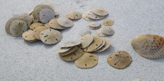
This is where shelling and beachcombing become part of the ecological story. Waves constantly sort and redistribute shells, fossils, small marine organisms and fragments of the living Gulf community.
Behind the beach, barrier islands and passes connect to bays and mangrove systems. Look closely and you will see that what washes onto the sand is a record of what lives offshore.
21. Charlotte Harbor & Boca Grande
Charlotte Harbor is another enormous estuarine system, and the barrier islands around it create a complicated network of passes, bays, mangroves, seagrass and shallow water.
Boca Grande and Gasparilla Island sit within that larger system rather than apart from it. Cayo Costa adds an important undeveloped barrier-island component.
The big story here is nursery habitat. Young fish and invertebrates need shallow, protected places to grow, and the combination of mangroves, seagrass and sheltered estuarine water provides exactly that kind of landscape.
22. Sanibel, Captiva & Pine Island
Sanibel changes the beachcombing story because its famous shells are really a lesson in coastal processes.
Shells arrive because marine animals live offshore. Waves move them. Currents sort them. The shape of the island influences where they accumulate. Wind, tides and storms constantly rearrange the beach.
But behind that shell-rich shoreline is an equally important mangrove and estuarine system. Sanibel and Pine Island are surrounded by shallow waters, mangrove habitat and tidal areas that support fish, birds and invertebrates. This is one of the clearest places in Florida to see the connection between beach finds and living coastal habitat.
23. Fort Myers Beach & Estero Bay
Estero Bay takes us deeper into the mangrove story.
The barrier islands protect an intricate estuary where mangroves line waterways, tidal creeks wind through shallow habitat and seagrass supports marine life beneath the surface.
The beach remains important for people and wildlife, but the real ecological engine is behind it. This is the kind of place where kayaking or walking a mangrove edge can reveal as much about Florida’s coast as standing on the sand.
24. Naples, Marco Island & Ten Thousand Islands
Southwest Florida becomes increasingly subtropical as the coast approaches the Everglades.
Marco Island still gives you broad Gulf beaches, but travel farther south and the landscape begins dissolving into mangrove islands, tidal channels and shallow flats. Ten Thousand Islands is one of the clearest expressions of this transition.
The mangrove forest becomes the coastline.
Instead of a single line where sand meets water, there are hundreds of winding edges. Mangroves stabilize sediments, shelter young fish and invertebrates, provide bird habitat and create structure in the shallow marine environment.
25. Upper Keys & Florida Bay
Then Florida changes completely.
The Keys are limestone islands rather than sandy barrier islands. The surrounding water is shallow, warm and tropical, and the ecological foundation shifts toward seagrass meadows, mangroves and coral reefs.
Florida Bay becomes particularly important because it is a vast shallow-water environment influenced by both the Florida mainland and the Keys. Seagrass meadows provide habitat for fish and invertebrates and feeding grounds for animals such as sea turtles and manatees.
26. Middle & Lower Keys
As you travel farther through the Keys, the tropical marine story becomes increasingly obvious.
Mangrove islands fringe the shoreline. Seagrass stretches beneath the shallow water. Coral communities occupy suitable hard-bottom habitat. Fish and invertebrates move between these systems during different stages of their lives.
The important thing here is not to think of mangroves, seagrass and reefs as separate attractions. They are connected pieces of one ecosystem. Seagrass can stabilize sediment. Mangroves shelter juvenile animals. Reefs provide complex habitat for mature fish and invertebrates. The health of one habitat can influence the others.
27. Key West, Marquesas & Dry Tortugas
At the far southwestern edge of Florida, the story becomes increasingly oceanic.
Key West sits within a marine environment influenced by the Gulf, Atlantic and Caribbean. Beyond it, the Marquesas and Dry Tortugas carry the story farther offshore into isolated islands, shallow banks, coral habitat and open water.
Florida’s coral reef system extends from the Dry Tortugas through the Keys and northward along the Atlantic coast. NOAA describes Florida’s Coral Reef as extending more than 350 miles and identifies the Florida Keys as home to North America’s only coral barrier reef.
This is Florida’s tropical climax.
And then we turn north.
28. Biscayne Bay & Miami’s Southern Coast
Moving back up Florida’s Atlantic side, the tropical marine story continues around Biscayne Bay and the southern Miami coast.
Key Biscayne, Virginia Key and the surrounding waters connect beaches, mangroves, shallow bay habitat and offshore marine environments. Here, the influence of the tropics remains obvious, but the Atlantic shoreline is becoming more exposed and more heavily urbanized.
The ecological transition is subtle. The sand looks familiar again, but the water, plants, fish and surrounding habitats carry the influence of South Florida’s subtropical environment.
29. Miami Beach & Biscayne’s Urban Shoreline
Miami Beach is one of the clearest examples of a natural system existing underneath an enormous human landscape.
The barrier island remains a barrier island. Waves still move sand. Tides still rise and fall. Fish still move through nearshore water. Birds still feed along the shoreline. Sea turtles still depend on suitable nesting beaches.
But the human footprint is enormous.
That makes Miami an important part of Florida’s ecological story because conservation here isn’t about pretending humans aren’t present. It is about figuring out how a heavily used coastline can continue to function for wildlife.
30. Hollywood, Dania & Hallandale
As you move north through Broward County, the Atlantic beach continues as a highly developed barrier-island environment.
The ecological fundamentals remain remarkably consistent: beach, nearshore water, dunes where they remain, inlets, tidal waters and offshore habitat. But each community has altered that natural system in different ways.
This is also where beach management becomes part of the ecological story. Sand nourishment, dune vegetation, lighting, access and recreation can all influence how wildlife uses the shoreline.
31. Fort Lauderdale & the Broward Coast
Fort Lauderdale and the surrounding Broward coast sit at an important marine transition because the Atlantic shelf and Gulf Stream influence the offshore environment.
The Gulf Stream flows northward through the Florida Straits and along Florida’s Atlantic coast, helping create conditions that support a rich marine community. FWC notes that the Gulf Stream’s influence becomes especially important along South Florida’s Atlantic shelf.
Onshore, the coastline is heavily urbanized, but offshore the story becomes increasingly tropical and marine.
32. Palm Beach & the Northern Gold Coast
Palm Beach begins to reveal another important Florida coastal feature: the relationship between the Atlantic shoreline and the Gulf Stream.
The water can be dramatically different here from northern Florida. Tropical species become increasingly common, while the coastline still retains its Atlantic barrier-island structure.
MacArthur Beach and other protected areas provide windows into what this coast looked like before development became dominant. Beach, dune, maritime vegetation, lagoon and nearshore waters remain connected even when the surrounding landscape is intensely developed.
33. Boca Raton & Southern Palm Beach County
South of Boynton Beach and toward Boca Raton, the Gold Coast continues the transition toward tropical South Florida.
The beach is highly developed, but inlets remain important ecological gateways between ocean and inland waters. Offshore marine habitat is influenced by the nearby Gulf Stream, while the shoreline itself continues to provide nesting and feeding habitat for coastal wildlife.
This is one of the places where the natural story and human story are almost impossible to separate.
34. South Treasure Coast: Jupiter & Juno
Jupiter and Juno mark the beginning of a different cultural and ecological feel along the Atlantic.
The coast becomes less dominated by the continuous urban intensity of the Gold Coast, and inlets become increasingly important. Jupiter Inlet connects freshwater and estuarine systems to the Atlantic, while the beaches continue to support sea turtles and coastal birds.
Juno’s long beach and relatively natural stretches give you a chance to experience the Atlantic shoreline as a functioning habitat rather than simply an urban waterfront.
35. Middle Treasure Coast: Hutchinson Island
Hutchinson Island is one of the places where the Atlantic barrier-island story becomes especially strong.
The island stretches between the Atlantic and the Indian River Lagoon system, creating a powerful contrast between exposed ocean beach and protected lagoon habitat. Sea turtles, shorebirds, dunes, mangroves and seagrass are all part of the larger ecological picture.
This is also where the Indian River Lagoon begins to become a defining feature of the Florida story. The lagoon is not the ocean, but it is intimately connected to it through inlets and barrier islands.
36. North Treasure Coast: Sebastian & Vero Beach
Sebastian and Vero sit within the extraordinary transition zone between Atlantic beach, barrier island and Indian River Lagoon.
The lagoon provides protected waters and extensive shallow habitat while the ocean side provides surf, dunes and nesting beaches. Sebastian Inlet connects the two systems and concentrates tidal exchange.
This region is a reminder that Florida’s barrier islands don’t simply separate land from ocean. In many places, they separate two completely different aquatic ecosystems.
37. Satellite Beach & Melbourne
The Space Coast continues that ocean-lagoon relationship, but adds another major character: extensive sea turtle nesting habitat.
The Atlantic beach stretches along the outside of the barrier island while the Indian River Lagoon occupies the protected side. Between them is a narrow strip of land carrying dunes, coastal vegetation, communities and infrastructure.
Look closely at the beach and you may notice that the sand is doing more than giving you somewhere to walk. It is nesting habitat, storm protection and a constantly moving part of the barrier island.
38. Cape Canaveral & Cocoa Beach
Cape Canaveral and Cocoa Beach bring together beaches, dunes, maritime habitat, the Indian River Lagoon and one of Florida’s most recognizable stretches of protected coastal landscape.
Here, the human story of space exploration sits directly beside an enormous natural story. The Cape’s protected lands allow coastal habitats to persist in a way that would be difficult in a heavily developed beach community.
As you move north toward the national seashore, the shoreline begins to feel increasingly wild again.
39. Ponce Inlet & New Smyrna Beach
Ponce Inlet changes the beach because an inlet changes everything.
Water moves through the opening. Sand moves around it. Fish concentrate around structure. Birds use the shoreline. Dolphins move through the estuary and inlet waters. Surfers, anglers and beach walkers all gather where the Gulf Stream-influenced Atlantic meets the inland water system.
New Smyrna continues the long beach experience, but the nearby Mosquito Lagoon and Canaveral National Seashore introduce a much larger protected coastal ecosystem.
This is where beach culture and coastal ecology sit side by side.
40. Daytona & Volusia Coast
Daytona and the surrounding Volusia coastline are among Florida’s most recognizable beach landscapes, but the broader ecological region includes far more than the famous driving beach.
North Peninsula State Park provides a glimpse of undeveloped barrier-island habitat. Tomoka adds river, marsh and lagoon systems. The beach itself supports sea turtles, shorebirds, crabs and marine life.
This region is particularly interesting because the human relationship with the beach is so strong. Driving, fishing, surfing and recreation are part of the identity, yet wildlife continues to use the same shoreline.
41. Palm Coast & Flagler
Palm Coast and Flagler bring us back to a more natural Atlantic shoreline, with coquina-rich beaches, high dunes, maritime hammock and protected coastal preserves.
Washington Oaks shows the geological personality of this section of the coast, where coquina rock forms along the shoreline. River to Sea Preserve connects beach habitat with maritime vegetation and inland waters.
The farther south you move from the heavily developed Daytona area, the more obvious the relationship between dune, forest, beach and water becomes.
42. St. Augustine Beaches
St. Augustine is where history and ecology become inseparable.
The beaches stretch beside one of the oldest continuously occupied European-established communities in the United States, but beyond the buildings are dunes, maritime forest, tidal marshes, inlets and protected coastal lands.
Anastasia State Park provides one of the best places to see the natural side of the region. Here, the beach isn’t just scenery surrounding a historic city. It is habitat, and the dunes are living infrastructure.
43. Ponte Vedra & Guana
Ponte Vedra is one of the most ecologically interesting transitions on Florida’s northeast coast because the beach is backed by the enormous Guana Tolomato Matanzas estuarine system.
The Gulf of America may be hundreds of miles away, but the ecological pattern is familiar: barrier beach in front, protected estuary behind. Salt marsh, tidal creeks, oyster habitat, seagrass, fish nurseries, birds and coastal forests all interact here.
The Guana Tolomato Matanzas National Estuarine Research Reserve protects an enormous network of estuarine habitat. This is a place where you can walk the beach and then turn inland and enter a completely different ecosystem without ever really leaving the same coastal story.
44. Jacksonville & the Atlantic Beaches
Jacksonville is where the northeast Florida coast becomes distinctly urban again, but it is surrounded by major ecological systems.
Hanna Park combines beach, dunes, freshwater lakes and maritime forest. The St. Johns River meets the Atlantic farther north, while the Intracoastal Waterway and surrounding marshes create extensive habitat.
Jacksonville also demonstrates the importance of thinking beyond the beach. A shoreline walk can reveal gulls and terns, shorebirds and ghost crabs, but the larger story includes marsh, river, forest and estuary.
45. Talbot Islands
Big Talbot and Little Talbot bring the northeast Florida story back toward a wilder barrier-island landscape.
Big Talbot’s famous weathered trees on Boneyard Beach reveal something important about barrier islands: they are not permanent pieces of land. They erode, migrate and change.
Little Talbot offers a longer stretch of relatively undeveloped beach, backed by dunes, marsh and maritime habitat. Huguenot adds another dimension with its important seabird habitat.
Here, erosion is not necessarily failure. Sometimes erosion is simply the natural process of a barrier island being a barrier island.
46. Amelia Island
And finally, we arrive at Amelia Island.
Here the Florida story comes almost full circle. Atlantic beach, dunes, maritime forest, salt marsh, tidal water and river systems all come together around a northern barrier island.
Fort Clinch and Amelia Island State Park provide particularly good examples of how much life can exist around a beach. Shorebirds work the wrack. Sea turtles nest in the sand. Dolphins move through nearby waters. Fish occupy the rivers and estuaries. Birds move between beach, marsh and forest.
And then there is the sand.
Northern Florida’s sand has a different character from the tropical limestone environment of the Keys. The vegetation is different. The water is different. The seasonal rhythms are different.
But the basic story is the same.
Land meets water.
Water moves.
Sand moves.
Plants hold things together.
Wildlife finds food and shelter.
And people walk through it all.
The Florida Coast Is One Story
If you trace this entire route on a map, you can see that Florida isn’t really a collection of separate coastal destinations.
It is one enormous ecological continuum.
You start in the western Panhandle with white quartz sand, dunes and barrier islands. You move through bays, dune lakes and estuaries, then into the marsh-dominated Big Bend. The coast becomes the spring-fed Nature Coast, where rivers meet shallow Gulf waters. Farther south, barrier islands surround Tampa Bay and Sarasota Bay, followed by Charlotte Harbor and the mangrove coast of Southwest Florida.
Then the landscape changes completely.
The Keys introduce limestone islands, enormous seagrass meadows, mangrove forests and coral reefs. NOAA describes the coral reef, seagrass and mangrove systems of the Keys as interconnected parts of one subtropical ecosystem.
Turn north along the Atlantic and the story gradually changes again. The tropical waters of South Florida give way to the urban Gold Coast, then the barrier islands and lagoons of the Treasure Coast, the sea turtle beaches and Indian River Lagoon of the Space Coast, and finally the estuaries, marshes, maritime forests and northern barrier islands of Northeast Florida.
That is the natural ecological storyline of Florida.
And it is why I don’t want you to simply ask, “Which Florida beach should I visit?”
Ask a different question.
What kind of coastline am I walking into?
Is it a dune coast?
A marsh coast?
A spring-fed coast?
A barrier island?
An estuary?
A mangrove shoreline?
A seagrass meadow?
A coral reef?
Because once you start asking that question, you stop seeing Florida’s beaches as places you visit.
You start seeing them as living systems.
And that changes the way you walk.
What I Hope You’ll Notice
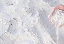
The next time you walk a Florida beach, look beyond the waterline. Notice what kind of sand is beneath your feet. Look at what is growing in it. Watch where the wrack collects. Look for tiny tracks above the tide line. Notice whether the beach is backed by dunes, marsh, forest or buildings. Look toward the water and ask what is living beneath the surface that you can’t see. Then turn around and look inland.
That is where the bigger story usually begins.
The bird flying overhead, the crab disappearing into the sand, the shell at your feet, the sea turtle track, the mangrove root, the seagrass meadow offshore and the dune grass holding the shoreline together are not separate stories.
They are pieces of the same one.
Florida is the story of water meeting land, and everything that happens because they do.
Keep Exploring Florida’s Coastal Story
Start with Coastal Wildlife to explore the animals and plants that make these ecosystems alive.
Then go deeper into Sand & Shore to understand the physical shoreline itself, from the sand beneath your feet to the dunes, erosion, wrack and coastal processes that shape each beach.
For the birds you encounter along the way, explore Seaside Birding, and for shells and other things you find while walking, visit Beach Finds.
The regional stories are only the beginning. Each individual beach has its own sand, wildlife, shoreline and personality, and that’s where the deeper walks begin.