


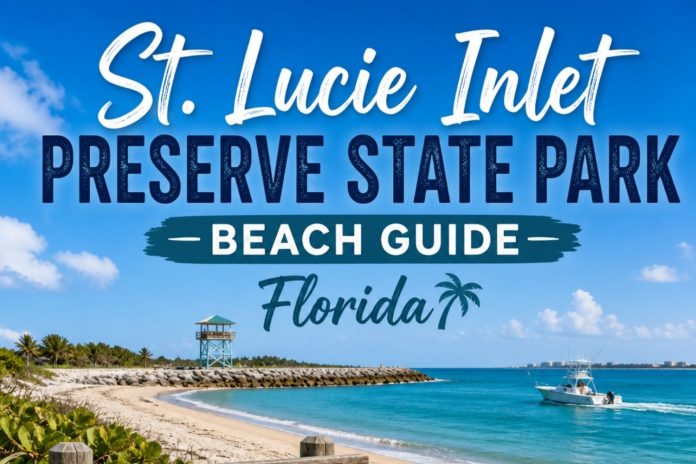
St. Lucie Inlet Preserve State Park, Florida
St. Lucie Inlet Preserve State Park is the one beach in this entire series you cannot simply drive to, and that single fact changes everything about what you’ll find here. There’s no parking lot, no road in, no way to reach this stretch of Jupiter Island except by boat, and after making that crossing more than once, I can tell you it’s one of the most genuinely wild places I’ve covered on this whole coast.
Despite the name, this park actually sits in Martin County, on the northern tip of Jupiter Island east of Port Salerno, named for the St. Lucie Inlet that separates it from Hutchinson Island just to the north. It’s a genuine outlier in this series, a 4,835-acre preserve, most of it submerged marine land, reachable only by private boat, canoe, or kayak launched from Cove Road Park or the Manatee Pocket marinas nearby.
In this guide I’m walking you through every distinct piece of this preserve, going deep on what the sand and water are actually doing here, scoring it honestly across every category that matters, and telling you exactly who this park is built for. I’ll cover the crossing itself, the mangrove boardwalk, the reef, what’s realistic if you’re bringing a dog along, and the turtle nesting ground that makes this one of the more ecologically significant stops in this entire series. For more on what lives here and what you might find in the sand, I’ve also written up a full hiking guide, a birding guide, and a beach finds guide for this preserve. I close with my own take on whether the boat trip is worth it.
The Vibe & Culture at St. Lucie Inlet Preserve State Park
A Beach That Makes You Earn the View
Every other beach in this series, you can simply drive to. This one asks you to cross open water first, and that single requirement changes the entire character of who shows up.
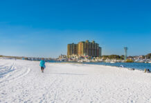
This barrier island has been Ais and Jeaga territory for centuries before European contact, and the state has managed it since as one of Florida’s genuinely undeveloped coastal preserves, standing in stark visual contrast to the built-up shoreline of Hutchinson Island just across the inlet. Nearly 4,000 of this park’s 4,835 total acres are submerged marine land, and the terrestrial portion protects a rare mix of mangrove forest, tropical hammock, and pristine Atlantic beach.
The park itself asks very little of visitors beyond the crossing. There’s an honor box for the modest boat fee, correct change required, a boardwalk leading from the dock through the mangroves to the beach, and essentially no other infrastructure beyond a picnic pavilion and a primitive group camp for organized youth and nonprofit groups. Everything else here is exactly as it would have looked before any of this coastline was ever developed.
The crowd reflects that access barrier honestly. You’ll find boaters who tied up specifically to walk the beach or snorkel the reef, kayakers who paddled across as part of a longer trip along the Intracoastal, and serious birders who know this stretch sits on the Great Florida Birding Trail. It never feels crowded, not because it isn’t worth visiting, but because getting here requires real effort most casual beachgoers simply won’t make.
St. Lucie Inlet Preserve State Park Areas: Six Distinct Pieces of a Boat-Only Barrier Island
This preserve is small in terms of visitor infrastructure but genuinely varied in what it protects. Here’s how it breaks down.
The Crossing & the Dock
Cove Road or Manatee Pocket · Boat, Canoe, or Kayak Only
Getting here is part of the experience, not just a logistical hurdle. Most visitors launch from Cove Road Park or one of the Manatee Pocket marinas, crossing the Intracoastal Waterway to the park’s extensive dock on the island’s western side. Timing matters more here than at almost any other beach in this series, since currents run strong through the inlet, and the smart move is timing your crossing for slack tide or launching about two hours before high tide for a comfortable four-hour outing.
The crowd making this crossing splits fairly evenly between private boaters who’ve done this trip before and kayakers treating it as a genuine paddling destination in its own right, since the route is part of both the Martin County Blueways system and the larger Florida Circumnavigational Saltwater Paddling Trail. An honor box at the dock collects the modest entrance fee, and correct change is genuinely required.
I always tell people planning this trip to treat the crossing itself as part of the reward, not just an obstacle. Watching the developed shoreline of Hutchinson Island shrink behind you as you approach a barrier island with no visible buildings at all is a genuinely rare experience this far south in Florida.
The Mangrove Boardwalk
From the Dock to the Beach · A 3,000-Foot Walk Through Real Wilderness
From the dock, a roughly 3,000-foot boardwalk leads visitors through dense mangrove forest and hammocks of live oak, cabbage palm, paradise tree, and wild lime, crossing one of the interior kayak trails along the way before reaching a shady corridor near the Coastal Berm Trail junction. It’s a genuinely immersive walk, wide and sturdy underfoot, that gives you a real sense of the island’s interior before you ever see the ocean.
The crowd here moves through steadily rather than lingering, most visitors treating the boardwalk as the path to the beach rather than a destination itself, though birders and nature students do slow down here specifically for the hammock habitat. Mangrove Cuckoos have been spotted along this stretch in summer, and migratory species pass through heavily in fall and winter.
I never rush this boardwalk, even though most people do. The tropical hammock species lining this walk, wild lime and paradise tree especially, aren’t something you’ll see at most of the beaches covered elsewhere in this series.
The Atlantic Beach & Turtle Nesting Ground
More Than Two Miles of Untouched Sand · A Genuine Nesting Site
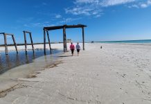
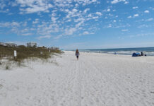
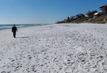
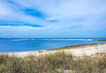
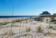
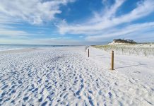
The beach itself is the payoff for the whole trip, more than two miles of pristine, undeveloped Atlantic shoreline with a stark, immediate contrast to the built-up coastline of Hutchinson Island visible across the inlet. During nesting season, loggerhead, leatherback, and green sea turtles all come ashore here at night to lay their eggs, making this one of the more ecologically significant nesting grounds covered anywhere in this series.
The crowd here is thin even by this preserve’s already-quiet standards, boaters who tied up specifically to walk this stretch, snorkelers heading for the reef just offshore, and a handful of surf anglers working the shoreline. There’s a picnic pavilion with tables and grills near the boardwalk’s end, and a beach wheelchair is available if you call ahead to the ranger station.
I’ve walked long stretches of this beach without seeing another person, and I’ve done that at plenty of beaches in this series, but never with quite this strong a sense that the shoreline directly across the water looks completely different from the one I’m standing on.
The Reef & Dive Site
About a Mile Offshore · The Northern Edge of Florida’s Coral Reef
Roughly a mile off this beach lies the northern range of Florida’s Coral Reef, an Anastasia rock reef running about 4.7 miles in length, with depths ranging from 5 to 35 feet and a real variety of coral, plant, and fish species. This is a genuinely significant natural feature, marking essentially the northernmost extent of the reef system that runs the length of the Florida Keys, and it’s protected as part of a designated aquatic preserve.
The crowd here is almost entirely snorkelers and certified divers, since reaching the reef itself typically requires a boat beyond just the crossing to the island. A diver-down flag is required by law, and spearfishing is prohibited within the preserve.
I think about this reef differently than most in this series, precisely because of what it represents geographically. Standing on this beach, you’re essentially at the northern edge of the same coral system that defines the Florida Keys, quietly extending this far up the coast without much fanfare at all.
The Coastal Berm Trail & Group Camp
North and South of the Boardwalk Junction · 3.4 Miles of Hiking Loops
Beyond the main boardwalk, the Coastal Berm Trail extends the hiking network in both directions, running north about 1.1 miles along a soft, sandy road past a group camping area and the North Kayak Landing before ending at a beach on the inlet side, and south roughly a mile to another quiet stretch of beach. Combined with the boardwalk, the full trail system covers about 3.4 miles across two loops.
The crowd here is almost exclusively hikers looking to see more of the island than just the main beach, plus the occasional organized youth or nonprofit group using the primitive camp, which accommodates about 10 tents and includes a campfire ring, though visitors must pack in and pack out everything, including trash, and cold showers and a primitive toilet sit about half a mile from the campsite.
I’d recommend the northern leg of this trail specifically if you have the time. It gives you a genuinely different perspective on the island, quieter even than the main beach, and it deposits you at a completely different stretch of shoreline on the inlet side.
The Kayak Trail Through the Mangrove Interior
Starting at the Great Pocket · Part of a Larger Paddling Network
An unmarked canoe and kayak trail winds through the island’s mangrove interior, starting from a crossing of the Great Pocket and threading through narrow, mangrove-lined waterways that connect to the boardwalk via a small bridge partway through. This trail is part of both the Martin County Blueways system and the much larger Florida Circumnavigational Saltwater Paddling Trail, which loops the entire state.
The crowd here is dedicated paddlers, often making this preserve one stop on a much longer trip rather than a standalone destination. It’s quiet, genuinely beautiful, and rewards patience with real wildlife sightings, otters, wading birds, and the occasional bobcat sign along the banks.
I think this interior paddling route might be the single best way to actually experience this preserve’s scale. The beach gives you the payoff, but the mangrove trail gives you the island’s actual character.
St. Lucie Inlet Preserve State Park Rankings: Expert Scores Across 11 Categories
These scores weigh the whole preserve on its own boat-only terms, since that access requirement shapes every category differently than at a typical drive-up beach.
Sand Quality
8/10
Genuinely pristine and undeveloped, with sand dollars a real find at low tide and none of the grooming or foot traffic that shapes more accessible beaches.
Hiking & Beach Walking
8/10
More than two miles of untouched beach plus a 3.4-mile network of boardwalk and trail loops give this small preserve real walking depth.
Shelling
8/10
Genuinely rewarding thanks to how little foot traffic this beach sees. Sand dollars turn up reliably at low tide.
Water Conditions
8/10
Clear water and a genuinely significant reef a mile offshore, marking the northern edge of Florida’s Coral Reef system. No lifeguard is present anywhere in the park.
Scenery & Natural Beauty
9/10
One of the wildest, least developed stretches of coastline in this entire series, with a striking, immediate contrast to the built shoreline just across the inlet.
Birding & Wildlife
9/10
A stop on the Great Florida Birding Trail, with peregrine falcons, broad-winged hawks, Mangrove Cuckoos, bobcats, and otters all realistic sightings.
Family Friendliness
5/10
The boat requirement and lack of lifeguard coverage make this better suited to families experienced with boating than a casual beach day with young kids.
Dog Friendliness
4/10
Leashed pets are permitted in the preserve but must be kept off the beach itself, a meaningful restriction for anyone hoping to let a dog run on the sand.
Solitude & Peace
10/10
About as high as solitude gets in this entire series. The boat-only access filters out all but the most dedicated visitors, and it shows on every visit.
Entertainment & Nightlife
1/10
None, and it never pretends otherwise. This is a genuine wilderness preserve, not a destination built for entertainment.
Parking & Beach Access
4/10
There’s no parking at the park itself, since there’s no road. Access depends entirely on a boat, canoe, or kayak launched from a nearby marina or park.
St. Lucie Inlet Preserve State Park Sand & Water
The sand here is about as undisturbed as anywhere in this series, wide and flat with a natural, undeveloped feel, since so little foot traffic ever reaches this beach in the first place. The upper beach stays soft, real sand dollars turn up at low tide for patient beachcombers, and the packed sand at the waterline gives you a firm, easy surface for walking the full two-plus miles.
The water runs a genuine turquoise on a calm day, with real Atlantic surf on the beach side and current worth respecting near the inlet itself. Entry is gradual on the open beach, though there’s no lifeguard anywhere in this park, so swim within your own limits. The reef about a mile offshore rewards calm conditions with good visibility, but that’s really a separate boat trip beyond the crossing to the island itself.
-
Walkability. Excellent along the full two-plus miles of beach, genuinely one of the more continuous, undisturbed walks in this entire series.
-
Softness & Playability. Soft and undisturbed on the upper beach, with sand dollars a real find at low tide for anyone willing to look.
-
Barefoot Comfort. Comfortable on the beach itself, free of significant rock structure except right around the reef zone offshore.
-
Swimmability. Good on a calm day, but there’s no lifeguard anywhere in this park. Swim within your own limits and stay aware of current near the inlet.
Want the full geology, grain composition, and the complete sand and water condition ratings? I broke it all down separately in Sand & Shore: St. Lucie Inlet Preserve State Park.
Dogs & Pet Accessibility at St. Lucie Inlet Preserve State Park
Are Dogs Allowed on the Sand? NO.
Leashed pets are welcome elsewhere in the preserve, but the beach itself is off limits, on top of the fact that reaching this park at all requires a boat.
Where Dogs Are Allowed
- ✓The boardwalk through the mangrove forest, on a leash.
- ✓The Coastal Berm Trail, on a leash, north and south of the boardwalk junction.
Where Dogs Are NOT Allowed
- ✗The Atlantic beach itself, no exceptions, leashed or not.
Paws on the Ground Reality
Bringing a dog here is a genuine commitment even before the pet rules come into play, since you’re already asking your dog to handle a boat crossing and a walk through mangrove forest before reaching any open ground at all. The trail system gives a leashed dog real, varied terrain to explore, sandy road, boardwalk, and forest, but the actual beach stays off limits the entire visit. There’s no fresh water provided anywhere on the island, so pack enough for your dog as well as yourself, and remember everything you bring in, including waste, needs to come back out with you.
Given the boat access alone limits who makes this trip, dogs here tend to be genuinely experienced boat and trail companions rather than a casual beach day addition. If a real beach run with your dog is the goal, this preserve isn’t the stop for it, save that for Jensen Beach or Stuart back on the mainland side of Martin County.
Crowd Levels and the Overall Feel of St. Lucie Inlet Preserve State Park
This preserve never fills the way any drive-up beach in this series does, and the boat-only access is the entire reason. Even on a beautiful weekend, the crowd here stays thin, spread across a beach more than two miles long.
You’ll find a different crowd depending on what brought them here. Boaters tie up specifically for a beach walk or a swim. Kayakers treat the crossing itself as part of a longer paddling trip. Birders and nature students come specifically for the hammock and mangrove habitat. Divers head straight for the reef.
The overall feel shifts by season more around turtle nesting and paddling conditions than typical tourist patterns:
- Spring: comfortable crossing conditions and the start of sea turtle nesting season
- Summer: peak nesting and hatching activity, plus Mangrove Cuckoos along the boardwalk
- Fall: strong migratory birding season, with warm water lingering and light crowds even by this preserve’s quiet standards
- Winter: the coolest, calmest crossing conditions of the year, and peak birding season overall
Who Is St. Lucie Inlet Preserve State Park Really For?
✓ Who Will Love St. Lucie Inlet Preserve State Park
-
Boat owners and kayakers looking for a genuine barrier island destination worth the crossing
-
Anyone chasing the most solitude available anywhere in this entire series
-
Snorkelers and divers wanting to visit the northern edge of Florida’s Coral Reef system
-
Serious birders chasing a genuine Great Florida Birding Trail stop
-
Sea turtle enthusiasts interested in a genuinely significant three-species nesting ground
-
Paddlers looking to connect with the Florida Circumnavigational Saltwater Paddling Trail
✗ Consider Another Beach If…
-
You don’t have access to a boat, canoe, or kayak. There is no road access to this park at all
-
You want a lifeguard watching the water. None are posted anywhere in this park
-
You’re bringing a dog and hoping to let it run on the beach. Leashed pets are permitted in the preserve, but not on the beach itself
-
You want amenities, dining, or a simple, low-effort beach day. This preserve asks real effort of every visitor
-
You’re new to boating in tidal inlets. The current here is genuinely worth respecting, and timing your crossing matters
Things to Do at St. Lucie Inlet Preserve State Park, Florida
Despite the access challenge, this preserve rewards visitors with a genuinely varied day. Here’s what actually fills a visit here.
-
Boating or Kayaking the Crossing. Launch from Cove Road Park or the Manatee Pocket marinas, timing your trip for slack tide or roughly two hours before high tide.
-
Walking the Mangrove Boardwalk. A roughly 3,000-foot walk through mangrove forest and tropical hammock connecting the dock to the beach.
-
Beachcombing. More than two miles of undisturbed beach reward patient shell and sand dollar hunters, especially at low tide.
-
Snorkeling and Diving the Reef. The northern edge of Florida’s Coral Reef sits about a mile offshore, with depths from 5 to 35 feet. A diver-down flag is required.
-
Birding. A stop on the Great Florida Birding Trail, with peregrine falcons, broad-winged hawks, Mangrove Cuckoos, and migratory species all realistic sightings.
-
Sea Turtle Watching. Loggerhead, leatherback, and green turtles all nest on this beach, making it one of the more ecologically significant nesting grounds in this series.
-
Hiking the Coastal Berm Trail. Extends the boardwalk network north and south, covering about 3.4 miles across two loops.
-
Surf Fishing. A genuine draw here, with snapper, snook, and sheepshead near the docks, and bluefish, pompano, and snook from the shoreline.
-
Paddling the Interior Mangrove Trail. An unmarked canoe and kayak route through the island’s interior, part of the larger Florida Circumnavigational Saltwater Paddling Trail.
Local Knowledge and Practical Advice
A few things I’ve picked up making this crossing more times than most people would consider reasonable:
-
This park is only reachable by boat, canoe, or kayak. Launch from Cove Road Park or the Manatee Pocket marinas, and don’t attempt this trip without real comfort navigating tidal water.
-
Time your crossing for slack tide. For a comfortable four-hour outing, launch roughly two hours before high tide to avoid the strongest current.
-
Bring exact change for the honor box. Fees run $3 per boat and $2 per canoe or kayak, and the box does not make change.
-
There is no lifeguard anywhere in this park. Swim within your own limits and stay especially aware of current near the inlet itself.
-
Leashed pets are allowed in the preserve but must stay off the beach. Plan accordingly if you’re bringing a dog.
-
A diver-down flag is required for the reef, and spearfishing is prohibited. The reef itself typically requires a separate boat trip beyond the initial crossing to the island.
-
Camping is limited to organized youth and nonprofit groups. The primitive site accommodates about 10 tents, with cold showers and a toilet roughly half a mile away.
-
Sea turtle nesting is a serious priority here. Avoid nesting areas and never disturb marked nests, particularly from May through October.
-
A beach wheelchair is available with advance notice. Call the ranger station ahead of your visit to arrange one, since the boardwalk ends some distance from the water itself.
-
Pack in and pack out everything, including trash. There are no concessions or regular trash service anywhere on this preserve.
Where to Stay Near St. Lucie Inlet Preserve State Park, Florida
There’s no lodging inside the preserve itself beyond the limited youth group camp, so most visitors base themselves on the mainland.
Port Salerno & Stuart
Vacation rentals and small hotels in Port Salerno and downtown Stuart put you close to the Cove Road and Manatee Pocket launch points for this preserve.
Hutchinson Island
Beachfront rentals across the inlet on Hutchinson Island offer a striking contrast, a developed shoreline within sight of this preserve’s undeveloped one.
Marina-Adjacent Stays
Several waterfront hotels and inns near the Manatee Pocket cater specifically to boaters heading out to spots like this preserve.
Youth Group Camping
A primitive camp inside the preserve is available by reservation, but only to organized youth and nonprofit groups.
Inland & Budget Options
Stuart and Port St. Lucie both offer a wider range of budget to mid-range hotel chains for visitors who’d rather stay inland and day-trip out to the preserve by boat.
What Makes St. Lucie Inlet Preserve State Park Different from Nearby Beaches
This preserve stands apart from every other beach in this entire series because of one simple fact, you cannot drive here. That single barrier shapes everything else about the experience.
A few features make it distinct:
The only truly boat-only beach in this entire series
Nothing else covered anywhere in this guide requires a boat, canoe, or kayak just to set foot on the sand.
The northern edge of Florida’s Coral Reef system
The reef offshore here marks the quiet northern extent of the same reef structure that defines the Florida Keys.
A genuine three-species turtle nesting ground
Loggerhead, leatherback, and green turtles all nest on this beach, a rare combination this far north on the Treasure Coast.
A direct visual contrast with developed Hutchinson Island
Few places in Florida let you stand on undeveloped sand while looking directly across the water at a fully built coastline.
St. Lucie Inlet Preserve State Park vs. Other Nearby Beaches
These are the beaches visitors most often weigh against this preserve, and the honest read on when you’d choose one over the other.
St. Lucie Inlet Preserve vs. Hobe Sound National Wildlife Refuge
Hobe Sound offers comparable wilderness and turtle nesting with the convenience of road access, at the cost of a small entrance fee. Choose this preserve specifically for the boat-only experience and the reef.
St. Lucie Inlet Preserve vs. Bathtub Beach
Bathtub Beach offers a manufactured-feeling calm lagoon with road access and lifeguards. This preserve offers the opposite, real effort required, real solitude delivered.
St. Lucie Inlet Preserve vs. Fort Pierce Inlet State Park
Fort Pierce Inlet State Park, covered elsewhere in this series, offers a comparable reef and surf history with a simple drive-up entrance fee. This preserve trades that convenience for a genuinely wilder, boat-only setting.
St. Lucie Inlet Preserve vs. Jensen Beach & Stuart
Jensen Beach and Stuart offer countywide leashed-dog access and full amenities within a short drive. This preserve offers neither convenience, trading both for a level of solitude nothing else in this series can match.
Bottom line: St. Lucie Inlet Preserve State Park isn’t competing with the rest of this series on convenience, and it never tries to. It offers the single most genuine wilderness experience covered anywhere in this guide, provided you’re willing and able to make the crossing to get there.
St. Lucie Inlet Preserve State Park, Florida: Frequently Asked Questions
Is St. Lucie Inlet Preserve State Park actually in St. Lucie County?
No. Despite the name, this park sits on the northern tip of Jupiter Island in Martin County, east of Port Salerno. It’s named for the St. Lucie Inlet, which separates it from Hutchinson Island to the north.
How do you get to St. Lucie Inlet Preserve State Park?
Only by private boat, canoe, or kayak. Most visitors launch from Cove Road Park or the Manatee Pocket marinas and cross the Intracoastal Waterway to the park’s dock.
What is the entrance fee at St. Lucie Inlet Preserve State Park?
$3 per boat and $2 per canoe or kayak, paid via an honor box at the dock. Correct change is required, since the box does not make change.
Are there lifeguards at St. Lucie Inlet Preserve State Park?
No. There is no lifeguard coverage anywhere in this park. Swim within your own limits and be especially cautious of current near the inlet.
Can you snorkel or dive at St. Lucie Inlet Preserve State Park?
Yes. The northern edge of Florida’s Coral Reef sits about a mile offshore, with depths ranging from 5 to 35 feet. A diver-down flag is required by law, and spearfishing is prohibited.
Which sea turtles nest at St. Lucie Inlet Preserve State Park?
Loggerhead, leatherback, and green sea turtles all nest on this beach, making it a genuinely significant multi-species nesting ground.
Are dogs allowed at St. Lucie Inlet Preserve State Park?
Leashed pets are permitted within the preserve but must be kept off the beach itself.
Can you camp at St. Lucie Inlet Preserve State Park?
Only in a primitive group camp reserved for organized youth and nonprofit groups, accommodating about 10 tents. There is no general public camping available.
How long is the beach at St. Lucie Inlet Preserve State Park?
More than two miles of undeveloped Atlantic shoreline, among the longest continuous, undisturbed stretches covered anywhere in this series.
Is St. Lucie Inlet Preserve State Park good for birding?
Yes, genuinely. It’s a designated stop on the Great Florida Birding Trail, with peregrine falcons, broad-winged hawks, Mangrove Cuckoos, and strong migratory activity in fall and winter.
Patti’s Perspective: My Honest Take on St. Lucie Inlet Preserve State Park
Every beach in this entire series has asked something of me, a drive, a walk, a fee, a bit of patience with a crowd. This is the only one that asked me to cross open water first, and I think about that difference every single time I make the trip back out here.
What stays with me most is standing on that undeveloped beach and looking directly across the inlet at Hutchinson Island’s rooftops and roads, close enough to see clearly, far enough to feel like an entirely different era. Most of the wild beaches I’ve covered in this series ask you to imagine what this coast looked like before development. This one lets you look at both versions at the same time, side by side, separated by nothing but a few hundred yards of moving water.
The crossing itself has become part of why I keep coming back. There’s something genuinely clarifying about timing a trip around slack tide, watching the current, and knowing that the effort itself is filtering out almost everyone who might otherwise crowd a beach this beautiful. It’s the same lesson Hobe Sound taught me further north in this series, but this one takes it even further. You cannot stumble onto this beach. You have to actually decide to come.
My honest caveat: don’t attempt this crossing without real comfort on the water, and don’t come expecting any of the conveniences this series offers elsewhere. Come specifically for what it is, one of the last truly wild stretches of coast in this entire guide, and the effort will make sense the moment you step off the boardwalk onto that sand.
My verdict: 8/10. The most genuinely remote, effort-required beach in this entire series, and it earns that ranking on wilderness and solitude that nothing else here can match. It asks real capability of every visitor, a boat, tidal awareness, and comfort with almost no amenities, but it delivers one of the last truly undeveloped stretches of coast left on Florida’s Treasure Coast.
Want to Live by the Water?Port Salerno and the surrounding Martin County mainland offer a genuine gateway to this preserve, with waterfront homes and marina-adjacent properties that put boaters within easy reach of one of the last undeveloped barrier islands on this coast.The market here draws boating families specifically drawn to easy marina access, along with buyers who value proximity to genuinely protected natural land over resort-style convenience. Port Salerno and nearby Stuart offer a range of waterfront options, from working marina neighborhoods to more polished riverfront properties, all within a short boat ride of this preserve’s undeveloped shoreline.
If living by the water is something you’re considering, whether full time, part time, or as an investment, it’s worth exploring what’s available in this area.
Explore Waterfront Living at LiveByTheWater.com
Real estate referral partner