



Little Talbot Island State Park, Florida
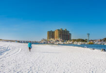
Little Talbot Island State Park covers an entire barrier island, and almost none of it has been built on. This is one of the last undeveloped islands left on Florida’s northeast coast, more than five miles of beach with no condos breaking the dune line, no beachfront restaurants, nothing but sand, surf, and a wilderness that the state has kept almost entirely intact since it became a park in the 1950s.
The island sits between Fort George Inlet to the south and Nassau Sound to the north, with Big Talbot Island, covered in its own dedicated guide, lying just across the water. Erosion has actually been reshaping the two islands over the decades, chipping away at Big Talbot while depositing that same sand onto Little Talbot, which is part of why this island now covers more ground than its neighbor despite the name.
In this guide I’m covering the north beach and its surf break, the genuinely dangerous inlet at the south end, the full-facility campground that anchors camping for the entire Talbot Islands system, and the trail network connecting all of it. I’ll go deep on what the sand and water are actually like on one of the few truly undeveloped islands left in this region, score it honestly across every category that matters, tell you exactly who this park fits and who should look for a beach with more built-in amenities, and cover exactly why your dog can join the campground but not the beach. I close with my honest take on a beach that asks for your attention and your silence in equal measure.
The Vibe & Culture at Little Talbot Island State Park
An Entire Island, Left Almost Entirely Alone
Cross the Fort George Inlet bridge, pass the last of the bait shacks along Heckscher Drive, and the road goes quiet. The canopy thickens. And then you’re on an island that Florida decided, decades ago, simply wasn’t going to get developed.
Little Talbot Island sits within the larger Timucuan Ecological and Historic Preserve, functioning as a genuine buffer between the rapidly growing Jacksonville metro area and a stretch of Atlantic coastline that’s stayed essentially wild. The park covers the entire island, more than 2,500 acres of maritime forest, towering dunes, and undisturbed salt marsh, and it’s part of the seven-park Talbot Islands State Parks system alongside Big Talbot, Amelia Island, Fort George Island, Yellow Bluff Fort, Pumpkin Hill Creek Preserve, and the George Crady Bridge Fishing Pier.
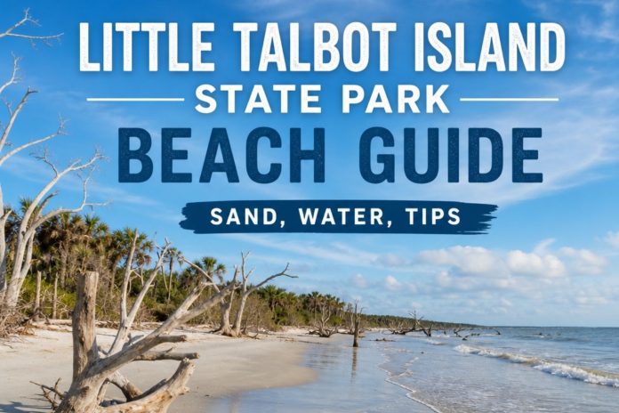
What makes this island’s story genuinely interesting is how actively it’s still changing shape. Erosion has been steadily wearing down Big Talbot Island to the north for years, and that same sand has been drifting south and depositing itself onto Little Talbot, which has grown large enough to overtake its neighbor in size. You can see an early preview of Big Talbot’s famous skeleton forest right here too, sun-bleached cedar and palm trunks eroding out of the dune bluff along Little Talbot’s own northern shoreline, a quieter, smaller-scale version of the spectacle that draws so many visitors just across the water.
The overall feel here is genuinely wild by Florida standards, surfers checking the break at the north end before sunrise, campers settling into a coastal hammock a short walk from the sand, and long stretches of beach where the only company you’ll have is shorebirds and the occasional angler working the surf. This isn’t a park built around amenities. It’s a park built around leaving an entire barrier island close to how it’s always been.
Little Talbot Island Areas: North Beach, South Inlet, Camp, and Trail
This island breaks down into a few genuinely distinct zones, and knowing which one you’re headed to matters more here than at almost any other beach in this guide. Here’s how I approach it.
The North Beach & Surf Break
Beach Accesses One Through Three · Where Swimming Is Actually Permitted
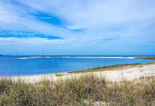
The northern stretch of Little Talbot’s beach is where nearly everything happens, the best surf on the island, the only areas where swimming is officially permitted, and views north across Nassau Sound toward an old shipwreck resting on the sand spit. This is considered one of the northernmost points in Florida where surfers reliably chase waves, and the break here holds up well enough that it draws a steady following of regional surfers year-round.
Walking this stretch, you’ll also notice sun-bleached, skeletal cedar and palm trunks eroding out of the dune bluff, a genuine preview of the far more dramatic boneyard beach at Big Talbot Island just across the water. Three bathhouses along this stretch provide changing stalls and outdoor showers, and dune walkovers make access straightforward from either of the two main parking areas.
The crowd here mixes surfers, families sticking to the designated swim zones, and anglers working the surf for bluefish, redfish, and flounder. My honest take, this is the stretch to plan your whole beach day around. Everything south of boardwalk three is a different story entirely, and I’ll get to that next.
The South End & Fort George Inlet
South of Boardwalk Three · No Swimming, Genuine Danger
The island’s southern tip narrows toward Fort George Inlet, where the water genuinely turns dangerous. Swimming and wading are prohibited south of boardwalk three because of steep drop-offs and fast currents where the inlet channel cuts through, and the state park is direct about this restriction rather than leaving it to visitor judgment. What you get instead is one of the more striking views in this entire guide, the chop of the inlet itself, and beyond it, the towering dunes of Huguenot Memorial Park across the water.
If you’re willing to walk about a mile past the park boundary, a path continues to the Fort George Inlet Bridge, with sweeping views over green water and sandbars framed by those same dunes. Anglers who know this stretch well fish the inlet itself for redfish, speckled trout, flounder, and the occasional snook, though wading here takes real caution given the current and the stingrays that work these shallows.
The crowd here is thin, mostly anglers and hikers making the walk out to the bridge rather than beachgoers settling in for the day. My honest take, come here for the view and the walk, not for the water. Read the closed-area signs and respect them completely.
The Campground & Myrtle Creek
Across A1A · The Camping Hub for the Whole Talbot Islands System
Little Talbot’s campground sits in a shaded coastal hammock on the opposite side of A1A from the beach, roughly a ten-minute walk or five-minute bike ride to the sand. Forty full-facility sites offer water, electric, fire rings, and picnic tables, accommodating tents, trailers, and RVs up to 30 feet, with two paved ADA-accessible sites and a separate youth and group tent camping area. This campground effectively serves as the base camp for the entire Talbot Islands system, since neither Big Talbot nor Amelia Island State Park offers camping of its own.
Myrtle Creek, a scenic tidal estuary, runs along the western edge of the campground, with a small dock and boat ramp for non-motorized boats making it an easy put-in for a quiet paddle. A small amphitheater hosts weekend interpretive programs, and a playground near the campground’s center keeps younger visitors entertained between beach trips.
The crowd here runs steady and loyal, families and regular campers who’ve made this island part of their seasonal routine, especially in the cooler months when the coastal hammock stays comfortable. My honest take, book ahead regardless of season. This is the only camping option for the whole Talbot Islands group, and that scarcity keeps it consistently in demand.
The Trail Network: Dune Ridge & the Timucuan Trail
4 Miles of Hiking · A 2+ Mile Paved Bike Path
Just inside the park’s main gate, the Dune Ridge Trail, formerly called the Island Hiking Trail, winds through shaded coastal hammock before climbing over massive dunes to reach the beach, a genuinely good sampler of the island’s full range of habitat in a single four-mile round trip. I’ve written a closer look at this specific trail separately, since the dune crossing deserves more attention than a passing mention. A shorter, roughly 0.8-mile Campground Nature Trail loops along the estuarine shoreline near the campsites, a good option for a quick walk without committing to the full route.
A paved bike path runs more than two miles along Park Drive from the entrance to the island’s southern tip, and the Timucuan Trail, part of the East Coast Greenway, threads through the park connecting toward Big Talbot Island to the north. A newer trail segment across the salt marsh through Long Island now links Little Talbot and Big Talbot directly, part of a longer-term vision connecting a continuous path from the Mayport ferry all the way through Amelia Island.
The crowd on these trails is thin and quiet, hikers and cyclists who came specifically for the island’s interior rather than just the beach. My honest take, bike the paved path if you’re short on time, and save the full Dune Ridge Trail for when you can commit half a day to it.
Little Talbot Island Rankings: Expert Scores Across 11 Categories
These scores reflect a genuinely undeveloped barrier island, which means it wins overwhelmingly on wilderness and scenery, and asks real attentiveness in return around water safety.
Sand Quality
8/10
Genuinely soft, white, undeveloped barrier island sand running the full length of the beach.
Hiking & Beach Walking
9/10
More than five miles of undeveloped beach plus a genuinely good inland trail system, one of the best combinations in this entire guide.
Shelling
7/10
Genuinely good, with metal detecting even permitted east of the dune vegetation, a sign of how much undisturbed material collects here.
Water Conditions
6/10
Genuinely excellent surf at the north end, but swimming is restricted to specific access points, and the water near Fort George Inlet at the south end is dangerous and off-limits.
Scenery & Natural Beauty
10/10
One of the last truly undeveloped barrier islands in Northeast Florida, with towering dunes, a shipwreck, skeleton trees, and sweeping inlet views. This is one of the most scenic entries in this entire guide.
Birding & Wildlife
9/10
A stop on the Great Florida Birding and Wildlife Trail, home to painted buntings, ospreys, river otters, marsh rabbits, and bobcats.
Family Friendliness
7/10
Genuinely good within the designated swim zones, with excellent camping for families, though no lifeguards anywhere on the beach ask for real attentiveness.
Dog Friendliness
4/10
Pets are not allowed on the beach itself, though leashed dogs are welcome on the hiking trails and throughout the campground.
Solitude & Peace
8/10
Genuinely quiet for an island this close to a major metro area, especially along the trails and the southern end near the inlet.
Entertainment & Nightlife
1/10
None, and that’s entirely the point. Weekend interpretive programs at the campground amphitheater are the closest thing to organized entertainment here.
Parking & Beach Access
7/10
A modest $5 per vehicle fee covers two parking areas and multiple boardwalks, straightforward for a park of this size.
Little Talbot Island Sand & Water
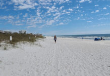
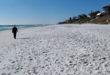
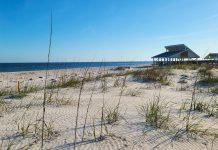
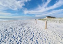
The sand here is soft, pale, and genuinely undeveloped, running the full five-plus miles of beach without a single building interrupting it. At low tide the hard-packed stretch near the water opens up wide enough to walk for miles, and there’s plenty of open, flat sand for a picnic or a full day’s setup away from the small parking areas. The dunes backing this beach rank among the more dramatic in this guide, tall enough that crossing them on the trail feels like its own small adventure.
Where you swim matters more here than almost anywhere else in this guide. North of boardwalk three, at beach accesses one through three, swimming is officially permitted, with genuinely good surf and a gradual entry on a calm day. South of that point, near Fort George Inlet, swimming and wading are prohibited entirely due to steep drop-offs and dangerous currents. There’s no lifeguard anywhere on this beach, so self-monitor and respect the boundary the park has drawn.
-
Walkability. Wide, soft, and genuinely excellent for long-distance walking, especially the hard-packed stretch at low tide.
-
Softness & Playability. Soft and comfortable throughout, with plenty of open, undeveloped sand for sandcastles and a full day’s setup.
-
Barefoot Comfort. Genuinely comfortable throughout, with the usual caution near shell-heavy patches close to the dune line.
-
Swimmability. Good north of boardwalk three, with no lifeguard on duty. Prohibited entirely south of it near Fort George Inlet.
Want the full geology, grain composition, and the complete sand and water condition ratings? I broke it all down separately in Sand & Shore: Little Talbot Island.
Dogs & Pet Accessibility at Little Talbot Island
Are Dogs Allowed on the Sand? NO.
Pets aren’t allowed on the beach here, but your leashed dog is genuinely welcome everywhere else in the park, the hiking trails and the entire campground included.
Where Dogs Are Allowed
- ✓The Dune Ridge Trail and Campground Nature Trail, on a leash.
- ✓The paved bike path along Park Drive, on a leash.
- ✓Throughout the campground, on a leash, for the length of your stay.
Where Dogs Are NOT Allowed
- ✗The beach itself, anywhere along the five-plus miles of shoreline.
Paws on the Ground Reality
The trail system here genuinely makes up for the beach restriction, shaded, varied terrain through maritime hammock and dune crossings that most dogs seem to enjoy just as much as sand. Bring your own water regardless, since the trailheads don’t have reliable fountains. Enforcement on the beach rule is consistent, since this restriction exists specifically to protect nesting shorebirds and sea turtles, so don’t test it even for a quick walk.
If camping here, you have the advantage of a real base to explore from, trails right outside your site, without ever needing to bring your dog onto the restricted sand.
Crowd Levels and the Overall Feel of Little Talbot Island
The crowd concentrates at the north beach access points, especially on good surf days, while the southern end near the inlet stays genuinely quiet, mostly anglers and hikers making the walk to the bridge. The campground runs steady year-round, busiest in the cooler months.
The overall feel shifts by season more around surf and wildlife activity than tourist traffic:
- Spring: comfortable crowds, strong migratory birding, and good surf conditions
- Summer: the busiest window at the north beach, with the campground filling for families on longer breaks
- Fall: my favorite season here, consistent surf, thinner crowds, and genuinely pleasant camping weather
- Winter: quiet and cool, with the coastal hammock campground staying comfortable even when the wind picks up on the beach
Who Is Little Talbot Island Really For?
✓ Who Will Love Little Talbot Island
-
Surfers chasing consistent waves at one of Florida’s northernmost real surf destinations
-
Campers who want a genuine base for exploring the entire Talbot Islands system
-
Hikers and cyclists who want a real trail network alongside their beach time
-
Birders and wildlife watchers drawn to painted buntings, river otters, and a genuine Great Florida Birding Trail stop
-
Anglers chasing productive surf and inlet fishing away from crowded piers
-
Anyone who wants genuine solitude and undeveloped coastline within a short drive of Jacksonville
✗ Consider Another Beach If…
-
You’re bringing a dog and want beach access together. Pets aren’t allowed on the sand here
-
You want to swim anywhere you like along the beach. Swimming is restricted to specific zones, with real danger south of boardwalk three
-
You want restaurants or amenities within walking distance. This is a genuinely undeveloped park, not a beach town
-
You need guaranteed lifeguard coverage. There’s none anywhere on this beach
-
You’re planning a spontaneous camping trip. This is the only campground for the whole Talbot Islands system and books up accordingly
Things to Do at Little Talbot Island State Park, Florida
Between the beach, the inlet, the trails, and the campground, this island offers genuine range for its undeveloped size.
-
Surfing. Consistent waves at the north end, among the more northern real surf destinations on Florida’s Atlantic coast.
-
Swimming. Permitted at beach accesses one through three, with no lifeguard on duty. Prohibited south of boardwalk three.
-
Fishing. Genuinely productive surf fishing island-wide, plus inlet fishing near Fort George Inlet for redfish, speckled trout, and flounder.
-
Hiking. The four-mile Dune Ridge Trail and the shorter Campground Nature Trail both offer genuine variety across the island’s habitats.
-
Biking. A paved path runs more than two miles along Park Drive, with the Timucuan Trail connecting toward Big Talbot Island.
-
Kayaking & Canoeing. A launch into Myrtle Creek near the campground offers calm, scenic paddling through the estuary.
-
Camping. 40 full-facility sites plus youth and group tent camping, serving as the base for the entire Talbot Islands system.
-
Birding. A stop on the Great Florida Birding and Wildlife Trail, with painted buntings among the standout species.
-
Metal Detecting. Permitted east of the dune vegetation, a genuine draw for serious beachcombers.
Local Knowledge and Practical Advice
A few things worth knowing before you plan a visit here:
-
Swim only at beach accesses one through three, north of boardwalk three. Swimming and wading are prohibited south of that point due to genuinely dangerous currents near Fort George Inlet.
-
Check the beach warning flags at the entrance before you go in. Double red flags mean no swimming at all, regardless of which section you’re on.
-
Leave your dog at the campsite for the beach. Pets aren’t allowed on the sand here, though leashed dogs are welcome on the trails and throughout the campground.
-
Book camping well ahead, in any season. This is the only campground for the entire Talbot Islands system, and demand stays consistent year-round.
-
Bike the paved path along Park Drive if you’re short on time. It’s an easy, scenic way to see the island without committing to the full Dune Ridge Trail.
-
Walk the extra mile to the Fort George Inlet Bridge if you can. The view back toward Huguenot Memorial Park’s dunes across the water is genuinely worth it.
-
Metal detecting is allowed east of the dune vegetation, but driftwood collection isn’t. Leave the sculptural, sun-bleached wood where you find it.
-
Visit at low tide for the full 5.5-mile stretch of hard-packed sand. It’s some of the best long-distance beach walking in this entire guide.
-
Check current fire restrictions before planning a campfire. Duval County periodically issues burn bans that affect campground fire rings.
-
Watch for stingrays if you’re wading near the inlet to fish. The current here is swift, and stingrays are a genuine, regular presence in the shallows.
Where to Stay Near Little Talbot Island State Park, Florida
Camping within the park is the primary option, since this campground effectively serves the whole Talbot Islands system.
Little Talbot Island Campground
40 full-facility sites with water, electric, fire rings, and tables, plus youth and group tent camping, all within a short walk or bike ride of the beach.
Amelia Island, North
For hotels and resorts, Amelia Island sits a comfortable drive north, covered in its own set of dedicated guides in this series.
Kathryn Abbey Hanna Park & the Jacksonville Beaches, South
Both offer additional camping and full hotel options a short drive south, covered in their own dedicated guides.
Historic Mayport Village
For a genuinely different overnight base, Mayport’s limited lodging options sit a short drive south, closer to the ferry connection north.
What Makes Little Talbot Island Different from Nearby Beaches
Little Talbot Island stands apart because it protects an entire barrier island rather than a stretch of it, and because it draws a genuinely clear line between where the water welcomes you and where it doesn’t.
A few features make it distinct:
A whole island, almost entirely undeveloped
Very few barrier islands this close to a major Florida metro area have avoided development this completely, and it shows in every direction you look here.
The camping hub for an entire state park system
This is the only place to camp across the whole Talbot Islands group, giving it a functional importance beyond its own considerable natural beauty.
A clear, honest line between safe and dangerous water
The state park doesn’t soften its warnings about Fort George Inlet, and that directness is part of what makes this such a trustworthy place to bring a family.
A living preview of Big Talbot’s boneyard
The skeleton trees along Little Talbot’s own northern shoreline show the same erosion process that made its neighbor famous, on a smaller, quieter scale.
Little Talbot Island vs. Other Nearby Beaches
These are the parks visitors most often weigh against Little Talbot, and the honest read on when you’d choose one over the other.
Little Talbot Island vs. Big Talbot Island State Park
Big Talbot, covered in its own dedicated guide, offers the full, dramatic boneyard beach experience but no camping and no swimming. Little Talbot gives you the fuller, more complete park experience.
Little Talbot Island vs. Huguenot Memorial Park
Huguenot allows beach driving and offers exceptional birding on a smaller, more developed peninsula. Little Talbot trades that convenience for a genuinely larger, wilder, undeveloped island.
Little Talbot Island vs. Kathryn Abbey Hanna Park
Hanna Park offers a freshwater lake, extensive mountain biking, and deep historical significance. Little Talbot offers a more purely wild, undeveloped barrier island experience.
Little Talbot Island vs. Amelia Island State Park
Amelia Island State Park offers horseback riding on the beach and a shorter, more focused visit. Little Talbot offers considerably more total beach, trail mileage, and camping.
Bottom line: Little Talbot Island State Park is the choice for anyone who wants a genuinely undeveloped barrier island experience within easy reach of Jacksonville, real surf, real camping, and a clear, honest relationship with where the water is safe and where it isn’t. Big Talbot gives you more drama in a smaller dose. Little Talbot gives you the whole island.
Little Talbot Island State Park, Florida: Frequently Asked Questions
Can you swim at Little Talbot Island State Park?
Yes, but only at beach accesses one through three, north of boardwalk three. Swimming and wading are prohibited south of that point due to dangerous currents near Fort George Inlet.
Is Little Talbot Island good for surfing?
Yes, genuinely so. The north end is considered one of Florida’s northernmost real surf destinations, with consistent waves year-round.
Can you camp at Little Talbot Island State Park?
Yes, at 40 full-facility sites plus youth and group tent camping. This campground serves as the base for the entire Talbot Islands state park system.
Are dogs allowed at Little Talbot Island State Park?
Leashed dogs are welcome on the hiking trails and throughout the campground, but pets are not allowed on the beach.
Is there a lifeguard at Little Talbot Island?
No, there are no lifeguards anywhere on this beach. Self-monitor and check the posted beach warning flags before swimming.
What is the difference between Little Talbot and Big Talbot Island State Parks?
Little Talbot offers a full-facility campground, swimming areas, surfing, and an extensive trail network across the entire island. Big Talbot, just north, is a day-use-only park known for its dramatic driftwood boneyard beach.
How much does it cost to enter Little Talbot Island State Park?
$5 per vehicle. The park is open 8am to sunset, 365 days a year.
Is Little Talbot Island good for fishing?
Yes, genuinely excellent, with bluefish, redfish, flounder, and sheepshead common in the surf, and speckled trout and occasional snook near Fort George Inlet.
Can you bike at Little Talbot Island State Park?
Yes, a paved path runs more than two miles along Park Drive, and the Timucuan Trail connects toward Big Talbot Island to the north.
How far is Little Talbot Island from Jacksonville?
About 17 miles, roughly a 25 to 30 minute drive.
Patti’s Perspective: My Honest Take on Little Talbot Island State Park
The skeleton trees along the north shoreline caught me off guard the first time I noticed them. I’d come specifically for Big Talbot’s boneyard beach on a previous trip and assumed that spectacle was unique to its own shoreline. Finding a smaller, quieter version of the same erosion story here, on the island everyone treats as the calmer, more developed sibling, reminded me that these two parks are really one continuous, ongoing geological story rather than two separate destinations.
My honest caveat, respect every boundary this park draws, the swim zones, the flags, the closed signs near the inlet. Do that, and this becomes one of the most complete, rewarding wilderness beach experiences in this entire guide.
Want to Live by the Water?The area surrounding Little Talbot Island State Park offers one of the more protected, low-density coastal settings left near Jacksonville, with the park’s status as an entire protected barrier island helping preserve the character of the surrounding communities.The market here draws buyers who specifically want proximity to genuine, undeveloped wilderness, surfers, anglers, and campers who use this park regularly, along with those drawn to the broader Timucuan Ecological and Historic Preserve’s protected status. Nearby communities in Atlantic Beach and along Heckscher Drive offer more traditional inventory for buyers who want easy access to this stretch of coast.If living near this kind of genuinely protected coastline is something you’re considering, it’s worth exploring what’s available in this area.Explore Waterfront Living at LiveByTheWater.com
Real estate referral partner