


Florida’s Big Bend Beaches
The Big Bend is where the sand stops. From St. Marks in the north to Cedar Key at the southern end, this is the only major stretch of Florida’s Gulf coast with no barrier islands, almost no quartz sand, and almost nothing built for the typical beach crowd. What it has instead is scallops, extraordinary fishing, exceptional birding, and the most genuinely empty, most biologically intact coastline left in Florida. It took me a few miles to understand what I was walking into. Now it’s one of the coasts I tell people about most.
The Big Bend is the geographic term for the sweeping curve where Florida’s east-west Panhandle coastline transitions to the north-south Gulf peninsula. It runs roughly from the Wakulla-Franklin county line in the north through Levy County in the south, covering Wakulla, Jefferson, Taylor, Dixie, and Levy counties. The communities along it, St. Marks, Panacea, Keaton Beach, Steinhatchee, Cedar Key, grew up around fishing and have stayed exactly that. There are no resort towns here and no plans for any.
The Big Bend Seagrasses Aquatic Preserve protects roughly 300,000 acres of seagrass beds offshore from Wakulla County through Levy County, making it one of the largest seagrass ecosystems in North America. That seagrass is the foundation of everything this coast produces: the bay scallops that draw summer snorkelers in from across the state, the spotted sea trout and redfish that keep the fishing culture alive in every small marina, and the habitat that makes the bird life here as dense and varied as anywhere in Florida.
If you’ve been reading the other guides in this Nature Coast series, you know what to expect on the sand: not much. What you will find at every stop is an intact working coastline, dead-end roads that lead somewhere worth going, and a sense of Florida before the resort industry decided what the Gulf coast should look like.
The Vibe and Culture of the Big Bend Coast
Fishing Culture, Dead-End Roads, and a Coastline That Got Left Alone
The Big Bend didn’t get forgotten by accident. The geography kept development out long before anyone had to fight for it. No harbor deep enough for large shipping, no barrier islands for resort development, and roads that lead somewhere specific rather than somewhere convenient.
Every community on the Big Bend coast sits at the end of a road that branches off US 98 and goes nowhere else. Keaton Beach, Steinhatchee, Horseshoe Beach, Cedar Key, you choose these places on purpose. The roads run through pine flatwoods, longleaf savanna, and coastal marsh, and by the time you reach the water the outside world has peeled away to the point where you notice it’s gone. That transition is part of what the Big Bend does that no more developed coast can replicate.
The fishing culture here is genuine rather than themed. The marinas smell like diesel and bait, not burger grease. The locals at the boat ramp are talking about tides and bait rather than the game on last night. In summer when scallop season opens, the towns at Keaton Beach and Steinhatchee shift into a particular kind of focused activity: people loading boats at dawn, coming back mid-morning with coolers, cleaning and shucking at the ramp, and eating what they harvested for dinner. That’s the seasonal rhythm of this coast, and it’s worth timing a visit to experience it directly.
Cedar Key sits at the southern end of the Big Bend and gives the region its most fully formed town character. The clam farming industry that sustained Cedar Key after its timber era ended in the 1880s is still running, and the small commercial district, gallery row, waterfront restaurants, and art community that have grown up around it make Cedar Key the most interesting overnight stop in the region by a wide margin. It also happens to be one of the premier birding destinations in Florida, which is not an accident given the Cedar Keys National Wildlife Refuge surrounding it.
The Big Bend Coast: Every Beach Stop, North to South
The Big Bend doesn’t have beach sections the way a barrier island beach does. It has communities and natural areas separated by long stretches of protected coastline accessible only by boat. Here’s every stop worth making, in the order you’d encounter them driving the Florida Big Bend Scenic Byway south.
St. Marks National Wildlife Refuge and the Wakulla Beaches
Wakulla County · $3/Vehicle or Duck Stamp · Open Sunrise to Sunset
St. Marks National Wildlife Refuge is where the Big Bend begins in spirit even if it technically starts at the county line. The refuge covers over 86,000 acres across Wakulla, Jefferson, and Taylor Counties, with the Lighthouse Road unit being the access point most visitors use. The seven-mile drive down Lighthouse Road from the visitor center to the lighthouse is a wildlife drive in the true sense: tidal pools along both shoulders, alligators warming on the road edge, bald eagles and osprey overhead, and white-tailed deer emerging from pine flatwoods at dusk. Drive it slowly. Drive it twice.
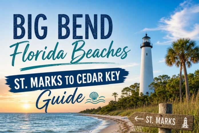
The St. Marks Lighthouse, completed in 1842, is the oldest operating lighthouse on the Gulf Coast. It stands where the St. Marks River meets Apalachee Bay, and the approach gives you one of the more dramatic reveals of any lighthouse on the Florida coast: the road opens up, the marsh flattens out in every direction, and the white tower appears against the sky with tidal flats and shorebirds working the shallow edges all around it. The keeper’s quarters are open Friday through Sunday from 11am to 3pm. The grounds are accessible anytime during refuge hours, gate opens at 6am.
The nearby county beaches at Shell Point and Mashes Sands (both in Wakulla County just east of the refuge) offer basic public access to Apalachee Bay. Shell Point has a small sandy-shell beach, a fishing pier, and boat ramp access. Mashes Sands has a modest beach park with a pavilion. Neither is a swimming destination in the traditional sense, but both give you the bay-edge experience of this coast with minimal infrastructure and the character that comes with that. Entry to St. Marks NWR is $3 per vehicle, or free with a Federal Duck Stamp.
Panacea and Ochlockonee Bay
Wakulla County · Small Fishing Village · Bridge to the Big Bend
Panacea sits on Ochlockonee Bay just east of the wildlife refuge, where US 98 crosses the bridge from Franklin County into Wakulla. It’s a small fishing community with a working waterfront character and the Florida State University Coastal and Marine Laboratory located just south of town, which has been conducting research on this coast’s seagrass and marine systems for decades. The lab is the reason Panacea sometimes shows up in scientific literature about Big Bend ecology even though it doesn’t appear in most travel guides.
The bay access here is informal, with a public boat ramp and the kind of restaurant that has been in the same family for decades. Angelo’s Seafood and Steaks is the local standby, known for fresh Gulf seafood and the kind of no-frills dining room that suggests the food doesn’t need help from the decor. It sits just across the bridge in Wakulla County and has fed generations of Bald Point visitors and wildlife refuge regulars.
You won’t find a traditional beach at Panacea. The waterfront is bay-facing, sheltered, and primarily a boat-launching operation rather than a swimming spot. What you’ll find is the small-town working-waterfront character of the Big Bend at its most intact, and a reminder that most of this coast was built around fishing rather than tourism. Panacea makes more sense as a fuel and food stop on a longer drive south than as a destination in its own right.
Keaton Beach and Hodges Park
Taylor County · Primary Public Beach · Scallop Season Opens June 15
Keaton Beach is where the Big Bend concentrates itself into one address during scallop season. The road south from US 98 runs through longleaf pine and flatwoods for about seventeen miles before the terrain flattens completely and the water appears. Hodges Park, the small Taylor County beach park at the end of the road, has a sandy beach, restrooms, a picnic pavilion, a fishing pier, a playground, and the county’s primary boat ramp. In winter, you can have all of this entirely to yourself on a Tuesday morning. In July, the boat ramp opens to a line of trailers an hour before dawn.
You’ll notice the water here is different from what you expect if you’ve been on Panhandle beaches. There’s no surf. The bottom visible in the shallows is seagrass rather than white sand. In summer, when the water clears over the grass flats offshore, the visibility runs to four or five feet, which is enough to watch bay scallops moving across the bottom and spot the bright blue eyes along their shell margins. That visibility, moderate by Gulf coast standards but enough to snorkel comfortably, is what makes Keaton Beach the scalloping hub it is.
The bay scallop season in the Keaton Beach and Steinhatchee zone runs June 15 through Labor Day, with a reduced bag limit of 1 gallon of whole scallops per person from June 15 through June 30. After July 1, the standard limit applies. Scalloping requires a valid Florida saltwater fishing license for anyone 16 and older unless you’re aboard a licensed charter. For anyone who has never done it: you wade or snorkel the seagrass flats in three to six feet of water, find the scallops by sight, and pick them off the grass by hand into a mesh bag. It is one of the more genuinely fun things you can do in Florida water, and Keaton Beach is the most accessible launch point for it on the Big Bend.
Dekle Beach and Adams Beach
Taylor County · No Facilities · Pure Dead-End Coast
Dekle Beach and Adams Beach are the Big Bend at its most uncompromising. The roads out to both are long and run through state-preserved land with no commercial stops, no gas stations, and no indication that anyone has tried to prepare these places for visitors. When you reach the water, what you find is access to the coastal edge, a boat ramp or a pulloff, and the Gulf of Mexico in front of you with nothing between you and the horizon except seagrass flats and the occasional pelican.
You’ll find a handful of vacation rental homes at Dekle Beach and the kind of sparse community that comes with a deep-water cut and a reliable fish population. Redfish and sea trout in the grass flats, Spanish mackerel offshore in season. The birding along the drive in, particularly through the Big Bend Wildlife Management Area parcels that line the roads south of US 98, can be as productive as the destination itself. Shore sparrows, clapper rails, Wilson’s plovers along the coastal fringe, and wading birds working every tidal pool.
My honest call on these two stops: they’re not destinations in the conventional sense. They’re the experience of going to the end of a road in Florida and finding that the coast there hasn’t been touched. That experience has value on its own terms, particularly for anyone trying to understand what most of this state’s coastline looked like before the twentieth century changed it. Come with a full tank of gas and low expectations about amenities, and come back with a memory of genuine solitude.
Steinhatchee
Taylor County · Scallop and Fishing Capital · June Through Labor Day
Steinhatchee (pronounced Steen-hat-chee) is the most developed town on the Big Bend coast, which is relative: it has a population well under a thousand, a handful of restaurants, several marinas, fishing charter operations, and one resort. What it doesn’t have is a beach. The Steinhatchee River meets the Gulf here, and the town sits along the river rather than on the coast. The waterfront is all dock and marina rather than sand and waterline.
What Steinhatchee does have is the best access to the Big Bend’s offshore fishing grounds for people who arrive by boat, and the most concentrated scalloping charter market in the region for people who don’t have their own. During scallop season from June 15 through Labor Day, the town operates at a level of activity that makes it feel busy by Big Bend standards, with charter boats running daily and the cook-your-own-catch option available at most restaurants in town. Sea Hag Marina is the largest operation and has been organizing fishing and scalloping trips out of here for decades.
The best thing Steinhatchee offers beyond fishing and scalloping is access to the Steinhatchee River itself for kayakers and paddleboarders. The river runs clear spring-fed water from upstream, darkening as it moves toward the Gulf, and the paddling through the tidal mangroves near the river mouth is worth a morning on any trip. Steinhatchee Landing Resort, with its Victorian-cottage accommodations set back from the river, is the best overnight option in the Taylor County Big Bend area and functions almost as a self-contained retreat for people who want access to the water without roughing it.
Horseshoe Beach and the Dixie County Coast
Dixie County · The Real Deep End · Suwannee River Mouth
Dixie County is the Big Bend at maximum remoteness. The county has no traffic lights, no McDonald’s, and no chain anything. Horseshoe Beach is the main coastal community, a small cluster of fishing cottages and homes at the end of County Road 351, with a boat ramp, a small public waterfront park, and direct access to the Gulf through a series of shallow channels through the seagrass. The drive in takes about thirty minutes from US 19 through flatwoods and marsh with no services along the way.
The draw here is fishing, and specifically the combination of seagrass flats and proximity to the Suwannee River influence on the water. The Suwannee drains an enormous swamp and forest system inland and carries significant tannins and organic material into the coastal zone, which supports a remarkably productive estuary. Redfish, sea trout, flounder, and sheepshead are the primary inshore targets, with offshore access by boat to grouper grounds. Horseshoe Beach has a dedicated local fishing community that largely keeps the place to itself, which is part of the appeal.
Further east, the Suwannee River meets the Gulf at the town of Suwannee, another tiny community accessible by a different dead-end road off US 19. The Suwannee River State Park and the Lower Suwannee National Wildlife Refuge together protect the river delta area, which creates some of the most intact coastal habitat in Florida. The paddling through the river delta channels is extraordinary for wildlife, but this is deep backcountry territory rather than a beach destination. If you have a boat and a sense of direction on a tidal estuary, the Lower Suwannee delta rewards the effort.
Cedar Key
Levy County · Old Florida Fishing Village · Southern Bookend of the Big Bend
Cedar Key is where the Big Bend gets a proper town, and it earns the time you give it. A causeway from the mainland connects the main island to US 98, and the commercial center, a few blocks of galleries, seafood restaurants, bait shops, and the historic district, faces the water in a way that feels like it was built before anyone decided what a Gulf Coast town was supposed to look like. Cedar Key was a significant place in the 1800s, first as a railroad terminus and then as the center of the pencil-manufacturing industry until the cedar forests were cut out by 1900. What was left afterward became a fishing village, and the clam aquaculture that grew up through the late twentieth century gave the town a stable economy that didn’t depend on tourism.
The City Park Beach at the south end of the main island has a sandy waterfront area, a kayak rental operation, and access to the bay for swimming and paddling. The water is Gulf-coast shallow and seagrass-floored, consistent with everything else on this coast, but the setting, a waterfront park in a working town with a real seafood culture behind it, gives it a character the more remote access points can’t provide. The Cedar Keys National Wildlife Refuge protects the surrounding cluster of keys, which are accessible by kayak or tour boat and hold nesting colonies of great blue herons, roseate spoonbills, brown pelicans, and magnificent frigatebirds. The birding around Cedar Key, particularly from a kayak at low tide on the seagrass flats, is legitimate enough to bring serious birders from significant distances.
Cedar Key’s scalloping zone, which falls under the Levy County dates, runs July 1 through September 24. Kayak rentals are available in town and the tour boats run daily to Atsena Otie Key, a nearby island with a historical cemetery from the town’s 1800s incarnation and a beach the mainland doesn’t have. If you’re staying overnight in the Big Bend, Cedar Key is the one stop where the evening makes as much sense as the morning, with a working waterfront to walk after dinner and galleries open later than you’d expect in a town this size.
Florida’s Big Bend Rankings: Honest Scores for an Honest Coast
The Big Bend is not competing with quartz-sand Gulf beaches. These scores reflect the Big Bend on its own terms as a coastal destination. Low sand and water scores are accurate and expected. Everything else tells the real story.
Sand Quality
2/10
The most honest score in this guide. The Big Bend coast has almost no sandy beach. Keaton Beach has a small maintained beach at Hodges Park. Cedar Key City Park has a modest waterfront. Everywhere else is seagrass over soft mud, shell hash, and organic sediment. This score is not a failing. It’s a description of a completely different kind of coastline.
Hiking and Coastal Walking
7/10
The Florida National Scenic Trail through St. Marks NWR offers 41 miles of trail through coastal wilderness, and the refuge’s 150-plus miles of levees and wildlife roads are open to hikers and cyclists. The Big Bend Wildlife Management Area parcels along the Taylor and Dixie county roads add trail access through productive habitat. This is not sand walking. It’s coastal ecosystem walking, which is a different and often better thing.
Shelling
5/10
Moderate and location-specific. Cedar Key’s waterfront after north winds produces fighting conchs, lightning whelks, and calico scallops. Keaton Beach’s Hodges Park is the best accessible shelling spot on the coast, particularly after winter storms. The Big Bend Seagrasses Aquatic Preserve limits what you can remove from the water. Check current rules before collecting anything live or attached.
Water Conditions
3/10
Dark, tannic, and murky over most of the coast. No surf anywhere. The one consistent exception is scallop season over the offshore grass flats, where water clarity runs four to five feet on calm days, enough to snorkel comfortably. The Steinhatchee River brings some spring-influenced clarity near its mouth on calm days. Neither the color nor the clarity will remind you of Clearwater Beach, and that’s fine once you understand what the water here is actually doing ecologically.
Scenery and Natural Beauty
9/10
Salt marsh extending to every horizon. The St. Marks Lighthouse standing white against a flat coastal sky. The Steinhatchee River winding through tidal mangrove toward the Gulf. Cedar Key’s waterfront at low tide with the keys scattered across the bay behind it. The Big Bend has a landscape identity unlike any other section of the Florida coast, and it earns a high scenery score on that distinctive character alone.
Birding and Wildlife
10/10
St. Marks NWR alone has documented over 350 bird species, including wintering waterfowl in concentrations that make national birding news. Cedar Keys NWR hosts nesting spoonbills, frigatebirds, and pelicans. The Big Bend seagrass flats support scallops, sea turtles, manatees, and some of the most productive inshore fishing in the state. This is the wildlife coast of Florida in the most literal sense.
Family Friendliness
5/10
The right family will love this coast. Scalloping is one of the best family activities available in Florida water, suitable for kids who can snorkel in chest-deep calm water. The wildlife watching at St. Marks and Cedar Key is excellent for curious children. But there are no lifeguards anywhere on this coast, no beach amenities for young children who want sand castles and shade, and the remoteness means being well-prepared matters more than usual.
Dog Friendliness
8/10
Most of the informal access points on the Big Bend coast allow dogs on leash, and the minimal crowds mean you’re unlikely to have conflicts. St. Marks NWR allows leashed pets on paved surfaces and most roads; check with the visitor center for specific restrictions on trails. Cedar Key’s City Park area is generally dog-welcoming. No federal wildlife refuge beach areas allow dogs on the nesting zones.
Solitude and Peace
10/10
You can drive for forty minutes between Steinhatchee and Keaton Beach on the back roads without passing another vehicle. You can stand at the end of a Dixie County road and see nothing human in any direction. You can walk the Lighthouse Road at St. Marks at dawn with only alligators and herons for company. The Big Bend’s solitude is not a marketing promise. It’s what happens when the infrastructure for crowds was never built.
Entertainment and Nightlife
2/10
Cedar Key has the region’s best evening options: a handful of genuinely good restaurants, a bar or two with local character, and gallery openings in season. Steinhatchee has dinner and not much else. Everywhere else, you eat at the one available option and call it an evening. Come with good company or a good book and this is not a problem. Come expecting a restaurant scene and you’ll be disappointed everywhere except Cedar Key.
Parking and Beach Access
7/10
St. Marks NWR charges $3 per vehicle or accepts a Federal Duck Stamp. Every other public access point on this coast is free. The access points themselves range from paved county parks (Hodges Park at Keaton Beach) to informal gravel pulloffs at the end of county roads (most of Dixie County). None of them are hard to find if you’re looking for them, and none of them are crowded enough to make parking a challenge.
Florida’s Big Bend Sand & Water
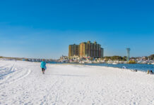
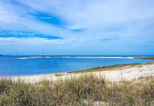
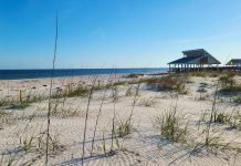
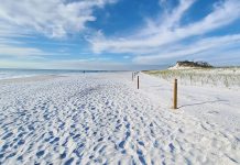
Sand is the wrong word for most of this coast, and it’s worth knowing that before you plan a beach day around it. Outside of two small maintained spots, Hodges Park at Keaton Beach and City Park in Cedar Key, the shoreline here is flat, narrow, and made of shell hash and soft mud rather than the wide, soft upper beach you’d find on a barrier island. Where sand does exist, it’s shell-flecked and modest rather than deep or powdery, so sandcastles and sunbathing spread-out-a-towel afternoons aren’t really what this coast is built for. Walkability follows the same pattern, easy and flat with your shoes on, genuinely uncomfortable without them.
The water tells an equally honest story. Expect a dark, tannic color close to shore, one to two feet of visibility on a good day, more like tea than the clear Gulf green you’d see further west. Entry is gradual and gentle everywhere, since there’s no surf anywhere on this coast, which makes it safe from a wave standpoint even though there are no lifeguards at any access point. The one real exception to all of this is the offshore grass flats in calm summer conditions, where the same water that looks murky from the beach opens up to four or five feet of visibility, clear enough to watch bay scallops moving across the bottom.
-
Walkability. Flat and easy underfoot, but only with shoes on. Water shoes turn this into a comfortable walk anywhere on the coast, and skip a lot of unnecessary discomfort.
-
Softness & Playability. Limited to Hodges Park and Cedar Key City Park, where a small, shell-mixed sand patch gives kids just enough to dig with a bucket for a little while. Everywhere else, expect shell hash and mud instead of a playable beach.
-
Barefoot Comfort. Low. Abrasive shell hash and soft organic mud make bare feet a bad plan at almost every access point on this coast. Bring water shoes and you’ll forget the issue entirely.
-
Swimmability. Calm and gentle, since there’s no surf anywhere here, but murky close to shore and best reserved for the offshore grass flats in summer, where clarity and scallop season line up together. No lifeguards anywhere on this coast, so swim within your own comfort level.
Want the full geology, grain composition, and the complete sand and water condition ratings? I broke it all down separately in Sand & Shore: Florida’s Big Bend.
Dogs & Pet Accessibility
Are Dogs Allowed on This Coast? MOSTLY YES, LEASHED, WITH REAL EXCEPTIONS.
Unlike a lot of the barrier island beaches in this series, most of the Big Bend’s informal access points are genuinely dog-friendly. The catch is that a meaningful share of this coast sits inside National Wildlife Refuges, where the rules are stricter and consistently enforced.
Where Dogs Are Welcome
- ✓St. Marks NWR allows leashed pets on paved surfaces and most refuge roads. Check the Visitor Center for any current trail-specific restrictions before you head out.
- ✓Hodges Park at Keaton Beach is informal and generally dog-welcoming on leash.
- ✓Cedar Key’s City Park area and the downtown waterfront are dog-welcoming on leash.
- ✓Cedar Key Scrub State Reserve and the Shell Mound Unit of Lower Suwannee NWR both permit leashed dogs on their trails.
Where to Be Careful or Leave Them Home
- ✗No National Wildlife Refuge on this coast allows dogs off leash, anywhere, at any time.
- ✗Cedar Keys NWR islands, including Atsena Otie Key, restrict dogs in posted nesting closure zones, and cottonmouth snake density on these islands is a real consideration for a curious dog.
- ✗Any posted shorebird or seabird nesting closure, at St. Marks or around Cedar Key, is off-limits to dogs regardless of leash status.
Paws on the Ground Reality
The shell hash and mud that make this coast tricky for bare human feet aren’t much kinder to paws. Bring your own fresh water for any dog accompanying you, since natural water sources here are brackish or tannic rather than drinkable. The flat levees at St. Marks are the easiest walking surface on the coast for a dog of any age, and the boardwalks at Cedar Key are similarly gentle.
Crowd Levels and the Overall Feel of the Big Bend
The Big Bend coast is quiet enough year-round that crowd levels are really only a concept during scallop season, when Keaton Beach and Steinhatchee see genuine activity at the boat ramps and along the waterfront. Even that activity is modest by any coastal Florida standard. Outside of the Taylor and Dixie county scalloping zones in summer, this coast operates at the pace of a working fishing community rather than a beach destination, which means weekdays look like any other day and seasonal shifts are driven by fishing seasons rather than school calendars.
St. Marks NWR draws birders year-round with peaks during fall and winter migration, but the refuge is large enough that it never feels crowded even on busy weekends. Cedar Key has a genuine visitor economy from the art community and the waterfront restaurants, and it runs noticeably busier than anywhere else on the Big Bend during the Cedar Key Seafood Festival in October and the Wildfest birding event in the spring. Outside of those specific events, the island town operates at a pace that accommodates visitors without being defined by them.
- Spring: Best birding window for northbound migration through St. Marks and Cedar Key. Cedar Key’s Wildfest event draws serious birders. Water warming toward scallop season. Minimal crowds at all but the most popular access points.
- Summer: Scallop season June 15 through Labor Day. Keaton Beach and Steinhatchee are as busy as they get, which is still modest. Hot, humid, and prone to afternoon thunderstorms. The water activity is concentrated on the offshore flats rather than at the shore access points.
- Fall: Cedar Key Seafood Festival in October draws a regional crowd. Southbound migration at St. Marks and along the coast. Temperatures moderate. The Big Bend’s best compromise between activity and solitude.
- Winter: Wintering waterfowl at St. Marks NWR in concentrations that draw national attention from birding communities. The rest of the Big Bend goes very quiet. Manatees begin moving toward Crystal River’s spring runs to the south. The best season to have the coast to yourself.
Who Is the Big Bend Really For?
✓ Who Will Love the Big Bend
-
Birders of any level, from the casual walker with a phone camera at Hodges Park to the serious lister at St. Marks NWR in winter. The Big Bend consistently produces species and quantities that put it in the top tier of North American birding destinations.
-
Anglers who want some of the most productive inshore seagrass flats in Florida for redfish, sea trout, and flounder, plus offshore access by boat from several marinas along the coast.
-
Families who come specifically for scalloping and treat the summer trip as a food-gathering adventure rather than a beach vacation. Kids who can snorkel in calm, shallow water love this activity without reservation.
-
Kayakers and paddlers who want undeveloped coastal wilderness routes through the Cedar Keys, the St. Marks levees, and the Steinhatchee River delta.
-
Old Florida culture seekers who want to eat fresh clams in Cedar Key, talk to a charter captain in Steinhatchee, and understand what the Gulf coast looked like before resort development was invented.
-
Anyone who specifically needs the experience of a coastline with no other people on it. The solitude here is not hyperbole.
✗ Consider Another Coast If…
-
You came for white sand and clear water. This coast has almost none of either, and no amount of patience or early morning arrival will change that.
-
You need beach amenities for young children, including lifeguards, shade structures, and safe sandy wading areas. None of those exist anywhere on the Big Bend coast outside of Hodges Park’s modest setup at Keaton Beach.
-
You want restaurant options and evening entertainment. Cedar Key has a few good spots, but the rest of the Big Bend will leave you eating at the one available option and going back to your rental by 8pm.
-
You’re uncomfortable driving 30-plus minutes on an unmarked county road without cell service to reach a destination with no facilities at the end of it. Several Big Bend stops require exactly that.
-
You’re in a hurry. The Big Bend takes time to understand and rewards people who give it more than a half-day drive-by.
Things to Do on Florida’s Big Bend Coast
-
Scalloping. The signature Big Bend experience. The Keaton Beach and Steinhatchee zone opens June 15 with a reduced bag limit (1 gallon per person) through June 30, then expands to 2 gallons per person through Labor Day. The Cedar Key zone runs July 1 through September 24. A Florida saltwater fishing license is required for anyone 16 and older. Local charter operations at Steinhatchee and Keaton Beach provide guided trips including gear.
-
Birding at St. Marks NWR. The wildlife refuge is a year-round birding destination, with peak concentrations of waterfowl in winter and migrating shorebirds in spring and fall. The seven-mile Lighthouse Road drive and the levee trails both produce consistent sightings. Over 350 species documented. Pick up a species checklist at the visitor center before heading out.
-
Kayaking the Cedar Keys and St. Marks. The Cedar Keys NWR islands are accessible by kayak from the Cedar Key town launch, with Atsena Otie Key as the primary destination. St. Marks NWR has canoe and kayak access via Tucker Lake and the coastal levee system. The Florida Circumnavigational Saltwater Paddling Trail runs through both areas, with primitive campsites available for multi-day trips.
-
Inshore Fishing. Spotted sea trout, redfish, and flounder on the grass flats year-round. Spanish mackerel offshore in spring and fall. Sheepshead around any structure. The Taylor and Dixie county flats are among the most productive in Florida and remain largely unfished by non-local pressure. Charter operations in Steinhatchee, Cedar Key, and Sea Hag Marina offer guided inshore and offshore trips.
-
Hiking the Florida National Scenic Trail at St. Marks. The Florida Trail runs 41 miles through the refuge, including a 17,350-acre designated wilderness section accessible only on foot. Day hikes on the levee system from Lighthouse Road offer wildlife-rich walking with minimal elevation change. The full through-route section requires a permit and overnight gear.
-
St. Marks Lighthouse and Keeper’s Quarters Tour. The keeper’s quarters at the 1842 lighthouse are open Friday through Sunday from 11am to 3pm. The grounds are accessible during all refuge hours. The lighthouse is the oldest operating lighthouse on the Gulf Coast and a genuine piece of Florida history in a setting that has changed very little since the original construction.
-
Cedar Key Clam Culture. Cedar Key’s clam farming industry operates on the shallow seagrass flats visible from the waterfront. The town’s restaurants serve Cedar Key clams in every preparation, and the working waterfront gives the food an authenticity that farm-to-table restaurants in cities spend money trying to fake. Order the clams first at any Cedar Key restaurant that serves them fresh.
-
Lighthouse Road Wildlife Drive and Photography. The best wildlife photography drive in North Florida. Go in early morning or late afternoon, drive slowly, pull into every turnout, and work the pool and marsh edges with whatever camera you have. Alligators, eagles, deer, and herons are consistent subjects. The light on the marsh at golden hour is the kind that makes landscape photographers arrive the night before to be sure they don’t miss it.
Local Knowledge and Practical Advice
A few things I picked up driving and walking this coast that would have made my first trip easier:
-
The scallop zone boundaries matter. Keaton Beach and Steinhatchee are in the Fenholloway-Suwannee Zone (June 15 through Labor Day). Cedar Key is in a separate zone (July 1 through September 24) with different bag limits. Always check FWC’s current regulations before you go, since dates and limits can change by year.
-
Cell service disappears on the county roads. The roads to Keaton Beach, Dekle Beach, Horseshoe Beach, and most Dixie County spots drop to no service for significant stretches. Download offline maps (Google Maps offline or OnX) before leaving US 19 or US 98, and know your route before the signal goes away.
-
The Federal Duck Stamp is worth getting before you go. The $25 Federal Duck Stamp covers entry to all National Wildlife Refuges including St. Marks. If you’re visiting St. Marks and planning any other refuge visits on your trip, it pays for itself immediately. It’s also required for migratory bird hunters and directly funds wetland conservation.
-
Insect repellent is a condition of the visit, not an option. Mosquitoes and biting gnats along the marsh edges at St. Marks, and along any coastal access point south through Dixie County, are relentless at dawn, dusk, and any calm, warm day after rainfall. DEET-based spray, not the natural-ingredient formulas. Wear light long sleeves in the morning if you’re walking the refuge levees before the heat builds.
-
Water shoes are required everywhere from Wakulla County south. Shell hash, oyster bars, and soft organic mud at almost every access point. Neoprene water shoes let you move freely between the car, the waterline, and the water without worrying about what’s underfoot. This is the single most practical piece of gear for a Big Bend visit.
-
Fill up on gas every time you pass a station. Gas stations on the county roads south of US 19 are sparse. Keaton Beach has no gas station. Horseshoe Beach has no gas station. Cedar Key has a marina with fuel, but it’s marine fuel. Fill up in Perry, Chiefland, or any US 19 town before turning south toward the coast.
-
Cedar Key’s Cedar Key Seafood Festival in October is worth the crowd. The town fills up for this one, which is not something that happens most of the year. Fresh seafood, local vendors, and live music in a setting that genuinely earns the event. Book lodging months ahead if you’re planning to attend.
-
Give yourself a full day between St. Marks and Keaton Beach. The distance is about 90 minutes of driving, but the experience of doing the Lighthouse Road wildlife drive, eating in Panacea, and still reaching Keaton Beach before dark requires an early start. Don’t try to add Steinhatchee or Cedar Key to the same day unless you’re comfortable skipping everything but the drive.
Where to Stay on Florida’s Big Bend Coast
Steinhatchee Landing Resort
The best lodging option in the Taylor-Dixie Big Bend section. The resort sits on the Steinhatchee River and offers Victorian-style cottage accommodations with full river access, a pool, and the closest thing to resort amenities available in the Big Bend interior. It’s the right base for a scalloping or fishing trip centered on the Steinhatchee area, and it doubles as a quiet retreat in the off-season when the scallop boats aren’t running. Book early for scallop season.
Cedar Key Lodging
Cedar Key has the most diverse overnight options on the Big Bend coast. Waterfront inns, bed-and-breakfast operations in the historic district, and vacation rental cottages on the island and the surrounding keys. The Island Hotel is a historic inn with a restaurant and bar and the kind of character that comes from a building that has been housing travelers since 1859. Several waterfront properties have direct access to the bay. Cedar Key makes the most sense as a multi-night base for anyone planning a full Big Bend exploration.
Vacation Rentals at Keaton Beach
Limited vacation rental cottages are available at Keaton Beach and along the Taylor County coast. These are working fishing community rentals rather than resort properties, and they come with boat access, fish-cleaning stations, and minimal frills. During scallop season they book early and at a premium. Outside of season they’re the most affordable Gulf-access lodging available in North Florida.
Camping at St. Marks NWR
The Florida Circumnavigational Saltwater Paddling Trail has primitive campsites within the refuge accessible to kayakers and paddlers. Primitive camping is also available at Big Bend WMA parcels along the Taylor and Dixie county coast for those hiking the Florida Trail sections through the region. No developed campground with amenities exists within the Big Bend coastal zone itself.
Tallahassee or Gainesville as a Base
For anyone wanting full hotel services and driving to the coast daily, Tallahassee (45 to 60 minutes from St. Marks) and Gainesville (about 60 minutes from Cedar Key) both offer the full range of chain hotels, restaurants, and services. This approach limits your time at the coast but removes the need to plan around remote-area supply runs.
What Makes the Big Bend Different from Florida’s Other Coasts
The Only Major Section of Gulf Coast Without Barrier Islands
From Bald Point in Franklin County through Levy County south of Cedar Key, there are no barrier islands between the shoreline and the open Gulf. That geographic fact determines everything else about this coast. The same flat limestone shelf that prevents barrier island formation creates the massive, shallow seagrass system that makes the Big Bend one of the most biologically productive coastal zones in North America. No barrier islands means no sand accumulation, no resort development, and no interruption between the marsh and the open water.
A Seagrass Ecosystem That’s Actually Working
The Big Bend Seagrasses Aquatic Preserve covers roughly 300,000 acres of seagrass beds that are among the healthiest and most intact in Florida. The scallop population that makes summer scalloping possible here is a direct indicator of that health: scallops are sensitive to water quality and seagrass density, and their persistence on the Big Bend flats reflects an ecosystem that’s functioning at a level the more developed sections of Florida’s coast stopped achieving decades ago.
Spring-Fed Rivers Entering the Gulf
The rivers of the Big Bend, the St. Marks, the Aucilla, the Steinhatchee, the Suwannee, come from the Floridan Aquifer rather than from mountain runoff. That aquifer-fed origin means the rivers run cold and clear at their headwaters and carry almost no sediment load to the coast. The spring system that underlies this entire region is what keeps the seagrass healthy and gives the area its distinctive relationship between freshwater and saltwater that you don’t find anywhere else on the Gulf.
Cedar Key as the Model for the Whole Coast
Cedar Key shows what a Big Bend coastal community looks like when it has a sustainable economic identity beyond fishing and scalloping. The clam aquaculture, the art community, the restaurant and lodging infrastructure, and the wildlife refuge surrounding it have created a town that functions as a destination rather than just a waypoint. The rest of the Big Bend coast is working toward or past that model, which makes Cedar Key worth understanding as the region’s most complete expression.
The Big Bend vs. Other Florida Coastal Regions
Big Bend vs. The Forgotten Coast (North)
The Forgotten Coast, particularly Carrabelle, Alligator Point, and St. George Island, has what the Big Bend doesn’t: real quartz sand, clearer Gulf water, and a more developed visitor infrastructure. The Big Bend has what the Forgotten Coast can’t match: scalloping on productive grass flats, Cedar Key’s cultural character, and solitude that extends uninterrupted for 150-plus miles. They’re the same general region with a character divide that the geology makes absolute.
Big Bend vs. The Springs Coast (South)
The Springs Coast at Crystal River and Homosassa takes the Big Bend’s spring-fed water concept and makes it the main event. At Crystal River, the spring clarity that only hints at itself in the Steinhatchee River area becomes 10-plus foot visibility year-round and the world’s most accessible manatee habitat. The Springs Coast has more amenities and a stronger tourism infrastructure. The Big Bend has more fishing culture and harder-to-reach solitude. Both are worth visiting on the same trip.
Big Bend vs. Clearwater and the Suncoast
These are not comparable by any relevant metric. The Suncoast has some of the best quartz sand in Florida, full resort infrastructure, and consistent crowds. The Big Bend has almost no sand and almost no one. The choice between them tells you everything about what you came to Florida for.
Bottom line: The Big Bend is the stretch of Florida Gulf coast where you go when you have stopped looking for the beach and started looking for the coast itself. There is almost no sand here, the water is dark, and the infrastructure for visitors is minimal by design. What is here is one of the last intact seagrass and marsh coastline systems in the Gulf of Mexico, a fishing culture that has survived because the geography made development difficult, and the particular kind of quiet that comes from a place the tourist economy hasn’t reached. That combination doesn’t exist anywhere else on the Florida Gulf.
Florida’s Big Bend Beaches: Frequently Asked Questions
Does the Big Bend coast have sandy beaches?
Almost none. Keaton Beach (Hodges Park) has the most developed sandy beach area on the coast. Cedar Key City Park has a small waterfront patch. Everywhere else, the shoreline transitions from shell hash to soft mud to seagrass flat with no traditional sandy beach in between. This is not a quartz-sand Gulf beach coast.
When is scallop season on the Big Bend?
For the Keaton Beach and Steinhatchee zone (Taylor and Dixie counties): June 15 through Labor Day, with a reduced bag limit of 1 gallon per person from June 15-30. For the Cedar Key zone (Levy County): July 1 through September 24. Always confirm current dates and limits with the Florida Fish and Wildlife Conservation Commission before you go, as seasons can change annually.
Do I need a fishing license to go scalloping?
Yes. A valid Florida saltwater fishing license is required for anyone 16 years and older harvesting bay scallops. Exception: if you’re on a licensed charter boat with a licensed captain who holds a commercial saltwater products license, the captain’s license may cover you. Confirm with your charter captain before you book.
Is the water clear enough to snorkel for scallops?
On the offshore grass flats during scallop season on calm days, yes. Typical visibility over the seagrass beds runs four to five feet, enough to spot scallops on the grass below you and pick them by hand. Inshore near the access points, the water is too murky for useful snorkeling. The clarity you need is on the flats two to four miles offshore, accessible by boat.
Are there lifeguards on the Big Bend coast?
No. There are no lifeguards at any location on the Big Bend coast, from St. Marks through Cedar Key. Swim at your own judgment. The calm, shallow water makes most spots manageable, but boat traffic during scallop season on the offshore flats requires extra awareness.
What is the best stop on the Big Bend coast?
Cedar Key is the most complete destination, with lodging, restaurants, kayak access, birding, and an authentic town character that none of the other stops can match. For birding specifically, St. Marks NWR in winter is exceptional and worth a special trip. For scalloping, Keaton Beach and Steinhatchee are the primary hubs. The right answer depends on what you came for.
How do I get to Keaton Beach?
From US 19 near Perry in Taylor County, take County Road 361 south approximately 17 miles. The road runs through pine flatwoods and Big Bend WMA land with no services along the way. Fill your gas tank before you leave US 19. Cell service drops significantly along the route and disappears entirely near the coast.
Are dogs allowed on the Big Bend coast?
Most of the informal access points on the Big Bend allow dogs on leash, and the minimal crowds mean enforcement is relaxed. St. Marks NWR allows leashed pets on paved surfaces and many of the refuge roads. Check with the visitor center for specific trail rules. No federal refuge areas allow dogs in designated wildlife nesting zones.
What is Cedar Key known for?
Clam farming (Cedar Key is the Clam Capital of Florida), fresh Gulf seafood, a small but serious art community, outstanding birding around the Cedar Keys NWR, and an Old Florida town character that predates modern coastal tourism. Cedar Key is the most culturally interesting stop on the Big Bend coast and rewards more than a quick drive-through.
Why does the Big Bend have no barrier islands?
The underlying limestone platform is too flat and shallow to trap the sediment needed to build barrier islands. The spring-fed rivers of the Big Bend carry almost no quartz sediment from upstream (unlike the Apalachicola and other Appalachian-draining rivers that built the Panhandle’s quartz beaches), and the gentle, protected shoreline has no wave energy to concentrate and build any material that does arrive. The result is an open, marsh-and-seagrass coast rather than the barrier island system that characterizes most of Florida’s Gulf shoreline.
Is the Big Bend good for fishing?
Exceptionally. The seagrass flats of the Big Bend Seagrasses Aquatic Preserve support some of the highest densities of spotted sea trout and redfish in Florida. Flounder and sheepshead are reliable secondary targets. Spanish mackerel appear offshore in spring and fall. Steinhatchee, Sea Hag Marina, and Cedar Key all have charter operations that can put you on fish without needing your own boat.
Patti’s Perspective: My Honest Take on the Big Bend
The Big Bend took me the longest to understand of any section of coast I’ve walked on this journey. I came expecting marshy shorelines and mucky sands and it delivered. But the beach parks along this stretch have created fun family play areas by importing sands and making the experience much more pleasurable.
The drive down Lighthouse Road at St. Marks on a winter morning is the moment I point to when I try to describe what the Big Bend actually gives you. The gate opens at 6am, the light is still low, the road is wet from overnight fog, and the marsh on both sides is doing exactly what it does regardless of whether anyone is watching. I stopped several times on the drive in for wildlife along the swampy terrain. I turned off the engine and watched herons, an osprey and an alligator. I’d planned to spend two hours there and stayed most of the day.
At Keaton Beach, I happened to arrive during scallop season without specifically timing it, and the boat ramp scene in the early morning told me everything about what this coast is actually built for. Families loading coolers before sunrise, kids in wetsuits, a general purposeful energy that had nothing to do with beach chairs or boardwalk bars. By mid-morning the boats were coming back, the coolers were heavier, and the fish-cleaning stations were busy. That is the summer culture of the Taylor County Big Bend, and it’s worth seeing directly.
My full hiking guide to this coast covers the trail routes at St. Marks and the paddling routes around Cedar Key: Hiking Florida’s Big Bend Coast. For the St. Marks trail system specifically, see the St. Marks NWR hiking guide.
My verdict: 2/10 as a beach experience, and I will keep saying that score is incomplete. The Big Bend has never been a beach destination. Some of the parks there make it nice for locals mostly, but it is not a place to visit for the beach. It succeeds as something else entirely. The fishing, the scalloping, the birding, the solitude, and the rare experience of a coastline that functions as a working ecological system rather than a tourist product are worth more than any sand score can communicate. Come knowing what you’re walking into, and come with time to let it work on you. The Big Bend rewards patience more than anywhere else I’ve walked on the Florida coast.
Want to Live on Florida’s Big Bend Coast?
The Big Bend coast remains among the most affordable waterfront living options in Florida, and that gap relative to more developed coastal markets has drawn increasing interest from remote workers, retirees, and buyers who value the working-waterfront lifestyle over resort amenities. Taylor and Dixie counties offer waterfront and near-waterfront properties at prices that the Panhandle and the Nature Coast south of Cedar Key haven’t seen in a decade. Cedar Key itself has seen growing real estate interest tied to the art community and the town’s unique character, though inventory remains limited by the island’s size and the historical preservation ethos of the local community. Levy County around Cedar Key, Wakulla County near St. Marks, and the communities along the Taylor and Dixie county coast all offer the rare combination of intact natural environment, low cost of living, and direct water access that the more developed sections of the Gulf coast charge significantly more for and often deliver less authentically. If the idea of a fishing community, kayak-from-the-back-door coastal lifestyle appeals more than a condo with a pool, this coast is worth a serious look before the gap between its prices and the rest of Florida closes further.
Explore Waterfront Living at LiveByTheWater.com
Real estate referral partner