

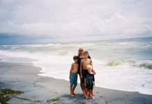



Deer Lake State Park, Florida
Deer Lake State Park is the one stop on all of 30A that most people who’ve driven this road a dozen times still haven’t properly explored. There’s a 1,920-acre park sitting between WaterSound and Seagrove Beach with one of the most extraordinary dune systems on the entire Panhandle, a rare coastal dune lake that connects to the Gulf through an outfall you can watch from the beach, and a half-mile of sugar-white sand that sees a fraction of the traffic of the community beach accesses surrounding it on both sides. The entry fee is $3 cash in an honor box. The experience is worth considerably more than that.
Deer Lake State Park sits on Scenic County Road 30A in South Walton County, tucked just east of Seagrove Beach and a short drive west of Alys Beach. It protects one of the rarest ecosystems on earth: a coastal dune lake that exchanges water with the Gulf of Mexico through periodic outfall events, creating a brackish zone where two entirely different bodies of water meet on the beach itself. Outside the Gulf Coast of Florida, this kind of lake exists in only a handful of places worldwide, including Australia, New Zealand, and Madagascar.
In this guide I’m walking you through every distinct zone of the park, going deep on the sand, the water, and the dune geology, scoring it honestly across all 11 categories, and telling you clearly who this park is built for and who would be better served at a neighboring beach. I cover the boardwalk crossing, the beach, the outfall zone, and the north-side trail system, and I close with my own experience walking this park and what made it stay with me long after I left.
The Vibe and Culture at Deer Lake State Park
30A at Its Quietest and Most Intact
Deer Lake State Park is what 30A looks like when you strip away everything that made it famous and keep only the land itself.
The 30A corridor is known for architecture, food culture, and a very specific brand of curated coastal living. The communities on either side of this park, WaterSound to the east and Seagrove Beach to the west, both have excellent rentals, well-designed streetscapes, and good restaurants within walking distance. Deer Lake has none of that. What it has instead is 1,920 acres of intact coastal Florida that protects an ecosystem so rare it’s been studied by scientists from multiple continents.
The visitors who find their way here tend to share a common quality: they came with a purpose. You’ll see birders moving slowly toward the outfall zone, photographers who set up before the boardwalk opened in the morning, families with school-age kids who arrived with water bottles and snacks and no expectation of a concession stand. You won’t see a lot of people looking around for something to do once they get here. The park provides its own agenda.
The overall pace here is slow in a way that takes a few minutes to adjust to. The walk from the parking lot to the water is not short, and the boardwalk crossing over the dunes is done entirely in the sun. There’s a reason the water bottle filling station at the trailhead is one of the first things you see, and a reason the park posts its capacity closure notices during summer. This place rewards people who planned for it, and surprises people who didn’t.
The surrounding 30A communities bring a certain demographic to the area: well-traveled, environmentally conscious, and genuinely interested in the natural side of the coast. That blends well with Deer Lake’s character. The contrast between the architectural precision of Alys Beach five minutes east and the raw, untouched dune field in the park itself is one of the more striking things about this stretch of 30A.
Deer Lake State Park: Five Distinct Zones, Five Different Experiences
This park rewards attention. Most visitors arrive, walk the boardwalk to the beach, swim, and leave. That’s a good visit. But there are four other distinct zones within these 1,920 acres that each offer something the beach itself doesn’t, and if you skip them you’re leaving the best parts of the park untouched.
The Pine Flatwoods Entry and Parking Area
Park Entrance · Honor Box Required
The entry road off County Road 30A leads you through a tunnel of slash pine and coastal scrub before you’ve seen a single grain of sand. That approach matters. It signals immediately that what’s ahead isn’t a conventional beach access, and the transition from the curated streetscape of 30A to the pine flatwoods takes about thirty seconds by car but feels much longer in terms of atmosphere.
The parking lot is modest by any measure: a paved area sized for a few dozen cars, restrooms to the right, a water bottle filling station near the boardwalk entrance, and an iron ranger honor box at the entrance split where you pay the $3 per vehicle fee in exact cash. There is no credit card reader, no attendant, and no signage visible from 30A telling you the lot might be full. In peak summer, the park regularly reaches capacity and may temporarily close to all visitors, including pedestrians and cyclists, for several hours at a time. The first time it happens to you, you’ll understand why arriving early matters here more than at almost anywhere else on this coast.
The picnic area is tucked alongside the parking lot, with tables, grills, and enough shade from the surrounding pines to make eating here genuinely comfortable in most seasons. I’ve packed lunch and sat here for an hour more times than I can count, listening to the birds work through the canopy before I walked the boardwalk. It’s a better way to arrive than rushing straight from the car to the beach.
The Boardwalk Over the Dunes
Signature Experience · Entirely Exposed
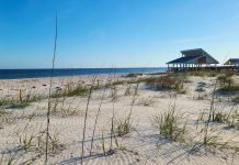
The boardwalk begins where the pine flatwoods end and the dune field starts. From the parking area, a sandy path leads to the kiosk with park information, then transitions onto the broad, elevated wooden boardwalk as the terrain shifts from pine understory to coastal dune. The change in landscape is immediate and dramatic: you go from dappled shade and pine straw to open sky, wind, and a wall of white sand rising on both sides.
The boardwalk runs approximately 0.3 miles one way and puts you above the dune field rather than cutting through it. That elevation is significant. You’ll notice it most about two-thirds of the way across, when the Gulf of Mexico becomes visible ahead of you while the dunes are still towering beside you. The moment the water comes into view, first as a sliver of emerald and then as a wide, open expanse as you clear the dune crest, is genuinely worth the walk in any season. I’ve seen it in January mist and in July glare and the reveal doesn’t get predictable.
What the boardwalk also does is protect the dunes. These are not low, rounded forms. They are some of the tallest and most intact coastal dunes on all of 30A, and the elevated walkway keeps foot traffic off the fragile dune face where the Choctawhatchee beach mouse, an endangered subspecies found only in the Panhandle dune systems, creates its burrow system. On a calm morning you can see its small tracks in the sand beside the boardwalk before the wind smooths them away. Walk the boardwalk, not around it.
The Gulf Beachfront
Half-Mile of Protected Gulf Sand
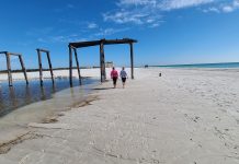
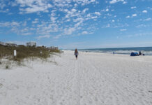
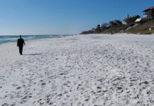
When the boardwalk deposits you onto the beach, the first thing you’ll notice is the space. The half-mile of Gulf-front sand at Deer Lake State Park is significantly wider than most community beach accesses along 30A, and it sees a fraction of the foot traffic. No umbrella rental operations have staked out rows here. No food trucks have pulled up at either end. The result is sand that feels more intact and consistent underfoot than the heavily worked stretches you’ll find at Grayton or at any of the 30A public beach accesses with large lots and high summer traffic.
The water here is the same emerald-to-turquoise Gulf as the rest of South Walton, and the sand bottom is the same white quartz that makes this entire stretch of coastline photograph so well. The dunes rising behind you are visible from the water, and that visual context, protected dune system on one side, open Gulf on the other, with no built structures in either direction, is the clearest illustration of why this park is worth protecting.
There are no lifeguards stationed here. The park posts warning flag signs and you should check them before going past your knees. The beach faces south with a gradual entry and typically light surf under normal conditions, but fronts moving through in fall and winter can push real wave action onto this stretch, and rip current risk increases with wind and swell the same way it does anywhere along this coast. The beach is excellent and the solitude is real, but the absence of staff on the sand means you swim with more self-reliance than at the developed parks. That’s not a reason to skip it. It’s a reason to know your conditions.
The Dune Lake Outfall Zone
The Lake-Gulf Exchange · East of Boardwalk Exit
Walk the waterline east from the base of the boardwalk and watch for it: a ribbon of water cutting through the beach where Deer Lake connects to the Gulf of Mexico when conditions align. The outfall doesn’t run every day. It opens and closes based on lake water levels, tidal pressure, and storm activity, and its size and speed change from visit to visit. Some days it’s a narrow, quiet channel. After a period of heavy rain that raises the lake, it runs wider and faster, and the visual contrast between the two bodies of water becomes unmistakable.
What you’re seeing when the outfall is running is one of the rarest natural phenomena on the Florida coast. Deer Lake is a coastal dune lake, a fresh-to-brackish body of water that formed behind the dune line roughly 10,000 years ago as sea levels stabilized. The water in the lake carries natural tannins from the surrounding cypress, pine, and coastal vegetation, giving it a rust-brown or tea-colored cast. That darker water bleeds into the clear Gulf in a visible swirl, creating a color boundary right at the beach that you can watch shift and move with the current. Locals call the color “pine straw tea,” and it describes it exactly.
The outfall zone is also the most productive wildlife zone in the park. Wading birds work the shallow edges where the two water types mix, and on calm mornings I’ve watched piping plover and reddish egrets in the same stretch of beach where the channel cuts through. The mix of fresh and salt water creates a concentrated feeding area, and the birds seem to know it. If you’re here for birding, this is the specific stretch you want to spend your time on, and early morning is the window when the activity peaks.
The Deer Lake Trail (North Side of County Road 30A)
Inland Trail System · Cross the Road to Access
To reach the north side of the park, walk back to the parking area, cross County Road 30A, and look for the walk-in trailhead marked with a yellow-tipped post. The Deer Lake Trail runs 1.5 miles through the inland portion of the park, and the ecosystem here is categorically different from the south side. You’re no longer in a dune and beach environment. You’re in pine flatwoods, basin swamps, depression marshes, and the forested edges of Deer Lake’s north bank.
The trail system includes a half-mile segment that reaches a scenic overlook of Deer Lake itself. From the overlook, you’ll see the lake’s north bank framed by cypress knees, sawgrass, and the emergent vegetation that fills the shallow margins. The water here often carries that dark, tannin-stained color from the surrounding vegetation, and the reflection of the pines on a still morning creates a quality of light that has nothing in common with the Gulf side of the same park. This is where the pitcher plants glow red and yellow in the wetlands, where the blue-flowering Gulf coast lupine appears in sandy disturbed areas along the paths, and where the spring azaleas bloom along the black water streams.
The flora on the north side of the park is one of the most ecologically significant aspects of the entire park experience. Deer Lake State Park contains one of the largest known populations of Curtiss’ sandgrass in Florida, along with populations of Gulf coast lupine, spoonflower, and pitcher plants that are rare enough to have been among the key reasons the park was placed on protection lists. The Timpoochee Trail, a paved multi-use path that connects 30A’s coastal communities, runs along this side of the road as well, making the north trailhead a logical connection point for anyone exploring the corridor on bike or foot.
Deer Lake State Park Rankings: Expert Scores Across 11 Categories
These scores weigh the full park experience, which means the extraordinary natural quality of the dune system and dune lake gets balanced against the real logistical limitations of a small parking lot, no amenities on the beach, and access restrictions that don’t suit every type of visitor.
Sand Quality
9/10
The same near-pure Appalachian quartz as the rest of South Walton, but noticeably less churned than the high-traffic community accesses nearby. Because fewer feet work this sand, it stays more consistent and powdery across the full beach width. One of the better-preserved stretches of quartz on all of 30A.
Hiking & Beach Walking
9/10
The boardwalk crossing is the finest short trail experience on all of 30A, and the Deer Lake Trail on the north side adds meaningful inland mileage through a completely different ecosystem. The beach walk itself is limited to a half-mile of Gulf front, which is the only reason this doesn’t score a 10.
Shelling
5/10
Not a dedicated shelling destination. The short beach length and protected character mean shell deposits are modest and inconsistent. Post-storm mornings after a Gulf blow can yield decent finds in the wrack line, but you’re not coming here specifically to shell. Come for the nature, not the collection bag.
Water Conditions
8/10
The same clear emerald Gulf water as the rest of South Walton, with a gradual sand shelf and typically light surf under normal conditions. No lifeguards on duty drops this from a 9. Check flag conditions at the posted warning signs before swimming, and plan your visit for calm-air mornings when the water runs clearest.
Scenery & Natural Beauty
10/10
This is a 10 and I don’t give those out easily. The combination of towering ancient dunes, rare coastal dune lake, Gulf-to-lake outfall visible on the beach, pitcher plants in the inland wetlands, and blue lupine flowering in the scrub adds up to an ecological range and visual depth that no developed 30A beach can approach. Extraordinary.
Birding & Wildlife
9/10
Exceptional across all seasons. Eleven natural communities within one park draw a species diversity that specialized parks can’t match. The outfall zone concentrates wading birds and shorebirds in a small, watchable area. Piping plover, reddish egret, little blue heron, white ibis, black skimmer, osprey, and migratory butterflies including monarchs in fall. The Choctawhatchee beach mouse is present but nocturnal.
Family Friendliness
6/10
Good for nature-oriented families with kids 7 and up who can handle the boardwalk walk in the heat. Less suited to toddlers and stroller-dependent beach days: the boardwalk is about 0.3 miles in the open sun, there are no lifeguards, no concessions, and no shade on the beach itself. Families who plan for it, meaning extra water, snacks, and sun protection, will have a genuinely excellent experience here.
Dog Friendliness
3/10
Dogs are welcome on a leash in the parking area and on the trail system, but they are not permitted on the boardwalk or the beach at any time. If the beach is your primary destination and your dog is coming, this park will not work for you. The trails are genuinely good for dogs, but the beach access restriction is firm and enforced.
Solitude & Peace
9/10
One of the quietest stretches of Gulf-front sand in all of South Walton. The small parking lot naturally limits visitors, and the boardwalk crossing further filters out anyone not committed to the walk. The beach rarely feels crowded even in summer, and by October you can have long stretches of it entirely to yourself on a weekday morning. The capacity closures are a nuisance but they’re also what keeps this from becoming Grayton on a July weekend.
Entertainment & Nightlife
2/10
There is nothing here after sundown, and nothing commercial here during the day either. No rentals, no concessions, no music, no gathering spots within the park. That is entirely the point. The 30A communities five minutes in either direction provide all the dining, entertainment, and nightlife anyone could want. Deer Lake provides the antidote to all of that.
Parking & Beach Access
5/10
A small lot, an honor box requiring exact cash, a 0.3-mile exposed boardwalk walk to the water, and regular capacity closures during peak summer season are real friction points. None of them are dealbreakers for a prepared visitor, but all of them together mean this is not the place to show up at noon on a Saturday in July without a plan. Check current park status before driving in during summer.
Deer Lake State Park Sand & Water
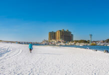
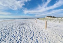
The beach at Deer Lake is flat, wide for a park this size, and about as soft as sand gets on this stretch of coast. Up near the boardwalk, the dry sand is fine and a little deep, the kind you sink into rather than walk across, while the wet sand right at the water’s edge packs down firm enough to walk quickly on. That firm strip near the water is where you’ll want to stay if you’re covering any real distance, since the soft upper beach slows almost everyone down. Sandcastles need a little water to hold their shape here. The dry sand alone won’t cooperate, but scoop a bucket from just above the waterline and you’re in business. Overall, it’s an easy, comfortable beach to spend a few hours on, just budget a little extra time to cross the soft stretch near the dunes before you settle in.
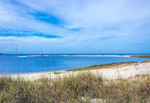
On a calm day, the Gulf here runs clear emerald to turquoise, sometimes with a visible darker current threading through it where Deer Lake’s outfall meets the sea. Entry is gradual, with no sudden drop-offs, so wading in feels easy on most visits. There are no lifeguards anywhere on this beach though, ever, so check the posted warning flag before you swim and treat this water with the same respect you’d give any unguarded stretch of Gulf coast. Rip current risk rises with wind and swell, especially after a front moves through, so calm, flag-clear mornings are your best and safest window.
- 🏖️ Walkability: Firm and easy right along the waterline, soft and slower going up near the dunes. Stay close to the wet sand if you’re walking any real distance.
- 🪣 Softness & Playability: The dry upper beach is soft enough for kids to dig in without much resistance, and a little water from the tideline turns it moldable enough for a real sandcastle.
- 👣 Barefoot Comfort: Genuinely comfortable most of the year, cool quartz that reflects rather than holds heat. It does get hot enough to bother bare feet on a still July afternoon, so plan around the morning or evening in peak summer.
- 🏊 Swimmability: Gradual entry and typically calm water on a settled day, but no lifeguards are ever on duty here. Check the flag, and save your swim for calm conditions.
Want the full geology, grain composition, and the complete sand and water condition ratings? I broke it all down separately in Sand & Shore: Deer Lake State Park.
Dogs & Pet Accessibility
Are Dogs Allowed on the Boardwalk or Beach? NO, NO EXCEPTIONS.
Dogs are welcome in the parking area and on the Deer Lake Trail with a six-foot handheld leash, but they are not permitted on the boardwalk or the Gulf beach at any time, under any circumstances.
Where Dogs Are Allowed
- ✓The parking area and picnic pavilion, leashed
- ✓The Deer Lake Trail on the north side of 30A, the full 1.5 miles, leashed the entire way
- ✓Nearby Grayton Beach State Park’s trail system, if you want to combine a dog walk with a visit to the sister park
Where Dogs Are NOT Allowed
- ✗The boardwalk crossing the dune field, no exceptions
- ✗The Gulf beach itself, no exceptions
Paws on the Ground Reality
If your plan for the day involves your dog on the sand, this isn’t the park for that. The rule is firm and consistently enforced, and there’s no workaround like there sometimes is at other parks with a bay-side exception. What you do get is a genuinely pleasant leashed trail on the north side, flat, partially shaded, and quiet almost every day of the week.
If a dog beach is the priority for your trip, look toward a county access with fewer restrictions, or plan the Deer Lake Trail as your dog’s outing and save the boardwalk and beach for a separate, dog-free visit.
Crowd Levels and the Overall Feel of Deer Lake State Park
This park draws a more intentional crowd than most beach access points on 30A. The logistics of the honor box, the exposed boardwalk walk, and the absence of amenities naturally filter out visitors looking for a simple, catered beach day. What you get in return is a mix of birders, hikers, photographers, families who planned ahead, and people who drove past this entrance fifteen times before they finally stopped. The beach rarely feels crowded even on summer weekends, because the parking lot capacity limits how many people can be here at once.
The crowd and the vibe shift meaningfully by season:
- Spring: the best botanical season, with Gulf coast lupine and other wildflowers in full bloom on the north-side trails; migratory birds passing through add species diversity that you won’t see in summer; the parking lot stays manageable before late May
- Summer: peak season and the highest capacity closure risk; weekdays are significantly better than weekends; arrive before 9am or plan on turning around; the water is warmest and the outfall zone is active after afternoon thunderstorms raise lake levels
- Fall: my favorite window here by a margin; warm water through October, lighter crowds after Labor Day, monarch butterflies passing through in September and October, and the outfall can run strong after a fall rainy season
- Winter: the park’s quietest and most private season; lifeguard towers are down everywhere along 30A but the beach at Deer Lake never had them in the first place, so the winter experience isn’t much different from summer in terms of facilities; the park stays open 8am to sunset daily, 365 days a year, and January morning walks here rank among the most peaceful on this coast
Who Is Deer Lake State Park Really For?
✓ Who Will Love Deer Lake State Park
-
Nature photographers who want something beyond the standard 30A beachscape: the boardwalk light, the outfall color contrast, and the wildflower season on the north side all offer images you won’t find at the community beach accesses
-
Birders chasing a serious species list: the outfall zone, the multiple wetland communities, and the migratory corridor position make this one of the better birding spots on the South Walton coast
-
Families with kids 7 and older who can handle the boardwalk walk and who came prepared with water and snacks rather than expecting a concession stand
-
30A visitors who want the same quartz sand and emerald water as the community beaches with none of the rental chairs, vendor traffic, or architectural backdrop
-
Hikers and cyclists on the Timpoochee Trail who want to add a state park visit to their route: the north-side trailhead connects directly to the 30A bike path
-
Anyone who wants to understand the rare coastal dune lake ecosystem in a context where you can see both the lake and the outfall to the Gulf in the same walk
✗ Consider Another Beach If…
-
You’re bringing your dog expecting beach access: dogs are not permitted on the boardwalk or the beach, and no exceptions are made
-
You have small children who need easy water entry, shade on the beach, lifeguard coverage, or nearby food and drinks: none of those things exist here
-
You arrived without cash: the honor box requires exact change and there is no digital payment option or attendant to help you
-
You want a full-day beach setup with umbrella, chair service, and cold drinks within reach: Grayton Beach State Park or the community accesses at Seagrove or Seaside will serve you better
-
You’re arriving at noon on a summer Saturday with no advance plan: the capacity closure risk is real and the drive in can end with a locked gate
Things to Do at Deer Lake State Park, Florida
The park’s range of ecosystems means the activity list here goes beyond anything a single-use beach access can offer. Bring more time than you think you need.
-
Boardwalk Hiking. The signature experience of the park. The 0.3-mile elevated boardwalk crossing the dune field to the beach is worth the trip on its own. Walk it early for the best light on the dunes and the quietest approach to the Gulf reveal.
-
Swimming. The half-mile of Gulf-front beach has a gradual sand entry and typically light surf under settled conditions. No lifeguards on duty: always check the warning flag signs before going past your knees, and plan your visit for calm conditions.
-
Birding. One of the strongest birding sites in South Walton. Concentrate time at the outfall zone east of the boardwalk exit for shorebirds and waders, and along the north-side trail margins for songbirds and wetland species. Piping plover, reddish egret, white ibis, black skimmer, little blue heron, osprey, and migratory species through spring and fall are all on the reasonable list here.
-
Wildlife Watching. Beyond birds, the park supports Florida black bear, coyote, white-tailed deer, and the endangered Choctawhatchee beach mouse in the dune system. The beach mouse is nocturnal, so you won’t see it in the daytime, but its tiny burrow entrances and track patterns in the sand beside the boardwalk are visible on calm mornings before foot traffic begins.
-
Surf Fishing. The full length of the Gulf beach is open for surf fishing. A Florida fishing license is required. The brackish zone around the outfall attracts a mix of species that move between fresh and saltwater environments, making it worth positioning near the outfall channel if conditions are right.
-
Lake Paddling. Deer Lake itself is accessible from the north-side trailhead. Bring your own kayak or paddleboard: there are no rentals in the park. The lake paddling, especially on flat, early-morning water with wading egrets and sunning turtles along the margins, is a genuinely different experience from Gulf paddling and worth the logistics of carrying equipment in.
-
Wildflower and Botanical Exploration. Spring is peak season for the inland botanical communities: Gulf coast lupine in blue flower along the north-side paths, pitcher plants glowing red in the wetland margins, and golden asters in the scrub openings. Summer wildflowers continue through July and August. Fall brings a different set of bloomers. Any season outside of peak winter has something to find on the Deer Lake Trail.
-
Nature Photography. The boardwalk dune crossing at golden hour, the outfall color boundary where lake water meets Gulf, the pitcher plants in early morning light, and the bird activity along the brackish zone all produce images with a specificity that generic beach photography can’t match. Early morning and late afternoon are the windows to plan around.
-
Timpoochee Trail Access. The Timpoochee Trail, a paved multi-use path connecting the coastal communities of 30A, passes alongside the north side of the park. The north-side trailhead connects directly to it, making Deer Lake a logical midpoint stop for cyclists and walkers covering the full 30A corridor.
-
Picnicking. A shaded picnic pavilion with tables and grills sits alongside the parking area. Pack a complete meal: there are no food options inside the park and the nearest restaurants are five minutes down 30A. The picnic area is the best place to settle in for a longer morning before the boardwalk crowd arrives.
Local Knowledge and Practical Advice
A few things I’ve picked up walking this park across multiple seasons that most first-time visitors don’t know until it’s too late:
-
Bring exact change for the honor box. The entry fee is $3 per vehicle, $2 per pedestrian or cyclist, and the honor box requires correct change. There is no attendant, no card reader, and nothing in the parking area that will make change for you. If you arrive with a $20, you either pay more than you owe or drive back down 30A to get change.
-
Arrive before 9am in summer to avoid the capacity closure. The park officially started posting capacity closure warnings in 2024. On busy summer days it reaches full capacity and closes to all visitors, including pedestrians and cyclists, until space opens up. Arriving before the heat builds and the day-tripper traffic starts is the most reliable way to guarantee entry.
-
Use the water bottle filling station at the trailhead and fill all of your containers before walking the boardwalk. There is nothing on the beach: no fountains, no food, no shade. The boardwalk walk back in the afternoon heat can be taxing in a way the walk in wasn’t, and running out of water on a July afternoon with a child in tow is a situation worth preventing.
-
Dogs can walk the trails but cannot go on the boardwalk or the beach. The rule is firm. If your plan involved bringing your dog to the water, adjust your destination to a dog-permitted beach. The Deer Lake Trail on the north side of 30A is a good leashed-dog trail, but the beach itself is off limits.
-
The dune lake outfall is east of the boardwalk exit, not west. Most visitors who’ve never seen a coastal dune lake outfall don’t know where to look. Walk east along the shoreline from the base of the boardwalk. The channel and the color boundary where the lake water meets the Gulf are in that direction. West takes you toward the wider open beach with no outfall visible.
-
The Deer Lake Trail is on the north side of County Road 30A. You have to leave the main parking area, walk to the road, cross it, and look for the trailhead markers. It’s not connected to the boardwalk on the south side. Many visitors miss it entirely because they assume the south-side experience is the whole park. The north-side trail, the lake overlook, and the botanical communities there are genuinely distinct from what you’ll find on the beach.
-
Sea turtle nesting runs May through October on this beach. Remove all chairs, towels, and personal equipment from the beach by sunset. If you’re on the sand after dark, use a red-filtered flashlight rather than white light, which can disorient nesting females and emerging hatchlings. The protected status of this beach means nesting activity here is less disturbed than at most Gulf-front parks with heavy summer visitor traffic.
-
Check the park’s capacity status before making the drive in summer. The Florida State Parks website and the park’s own social media channels sometimes post same-day capacity closure notices. If you’re driving more than 20 minutes to get here on a peak summer weekend morning, a quick check before you leave can save a wasted trip.
-
Come back in spring if you visit first in summer and think the north trails are unremarkable. The botanical season peaks in spring and the wildflower display along the Deer Lake Trail is categorically different from the same trail in August. Gulf coast lupine in full blue flower and pitcher plants in the wetland margins are worth a dedicated trip if you have any interest in Florida’s native coastal plant communities.
Where to Stay Near Deer Lake State Park, Florida
Deer Lake State Park has no camping or lodging of its own. All visitor accommodations are in the surrounding 30A communities, which offer everything from rustic vacation cottages to high-end beach homes, plus a lower-cost mainland option for visitors working with a tighter budget.
Seagrove Beach Vacation Rentals
Seagrove Beach, directly west of the park, is one of the oldest and most established communities on 30A, with a mix of classic Gulf-front cottages and newer vacation rentals at a variety of price points. It’s the closest lodging base to the park entrance and gives you walkable or bikeable access to the boardwalk trailhead via the Timpoochee Trail. Seagrove is more relaxed and lower-key in character than the planned communities to the east, which makes it a good match for visitors coming specifically for the park and the natural side of 30A.
WaterSound and Alys Beach
WaterSound is directly east of the park, a gated community with Gulf-front and lakeside properties centered around WaterSound Beach, one of the more private and architecturally restrained access points on the corridor. Alys Beach, further east, is one of the most design-forward communities on 30A and carries some of the highest rental rates on the coast. Both put you within five minutes of the park by car or bicycle.
Seaside and Rosemary Beach
Seaside, about eight miles west of the park along 30A, is the original planned community on the corridor and still one of the most well-known. It offers a full range of dining, shopping, and events, and puts you close enough to Deer Lake for a day trip by bike on the Timpoochee Trail. Rosemary Beach, further east of the park near the Walton-Bay county line, is another high-end planned community with strong rental inventory and 30A character without the Seaside crowds.
Camping at Grayton Beach State Park
The nearest camping option to Deer Lake State Park is Grayton Beach State Park, about eight miles west along 30A. Grayton offers tent and RV sites with electric hookups, hot showers, and access to Western Lake, another rare coastal dune lake. It’s the sister park to Deer Lake under the same management, and combining both parks in a camping trip makes a complete South Walton dune lake experience. Reserve through the Florida State Parks reservation system well in advance for summer dates.
Santa Rosa Beach and US 98 Corridor
For lower-cost options, the mainland town of Santa Rosa Beach along US 98 sits a short drive north of the 30A corridor and offers a significantly wider range of budget to mid-range hotel and motel options. The drive down to 30A and the park is 10 to 15 minutes, and the nightly rate difference compared to Gulf-front 30A rentals can be substantial. A good option for visitors who want park access without a 30A rental budget.
What Makes Deer Lake State Park Different from Nearby Beaches
Most 30A beach access points are variations on the same experience: white sand, emerald water, varying degrees of development and crowd. Deer Lake is genuinely different in several ways that have nothing to do with the quality of the sand.
The boardwalk crossing you have to earn
No other beach access on 30A requires you to cross a towering dune field on an elevated boardwalk to reach the water. That 0.3-mile crossing does something to the experience of arriving at the Gulf: the reveal, when the water comes into view as you crest the dune system, is earned in a way that pulling into a parking spot and walking 100 feet to the beach is not. The boardwalk also protects the dunes rather than cutting through them, which means those dunes are still here at their original scale.
A coastal dune lake outfall visible on the beach
There are 15 coastal dune lakes along 30A, but only a few are positioned so that their outfall is directly viewable at beach level without hiking to find it. The Deer Lake outfall, when running, cuts a visible channel through the beach sand and creates a color boundary between the tannin-stained lake water and the clear Gulf that you can watch from where you’re standing. This is a dynamic, changeable phenomenon, not a static feature, and it makes the beach here behave differently on different visits in a way that most 30A beaches simply don’t.
1,920 protected acres with no development visible from the beach
Standing at the waterline at Deer Lake State Park, you look at dunes behind you, open Gulf in front, and no condos in either direction. That view exists because 1,920 acres of land behind this beach has been in state protection. The difference in visual character between this beach and any developed 30A community access is immediate, and it compounds the longer you stay.
The botanical density and rarity of the inland communities
The north-side trail system at Deer Lake contains one of the largest known populations of Curtiss’ sandgrass in Florida, along with pitcher plants, Gulf coast lupine, spoonflower, and Cruise’s golden aster that are rare enough to have driven the park’s conservation designation. No other beach park in South Walton puts an ecologically significant botanical preserve directly behind its Gulf frontage.
Deer Lake State Park vs. Other Florida Panhandle Beaches
These are the parks and beaches most often considered alongside Deer Lake, and the honest read on when you’d choose one over the other.
Deer Lake State Park vs. Grayton Beach State Park
Both are state parks protecting coastal dune lakes on 30A. Grayton Beach has a larger and better-known dune lake in Western Lake, established camping facilities, more developed visitor infrastructure, and a longer Gulf beach. Deer Lake is quieter, more ecologically dense in its inland communities, and the boardwalk crossing gives it a more distinctive arrival experience. Choose Grayton for a camping trip or a longer stay with more amenities. Choose Deer Lake when you want the least-developed park experience on the corridor.
Deer Lake State Park vs. Topsail Hill Preserve State Park
Topsail Hill Preserve, about 18 miles west near Destin, protects three miles of Gulf-front beach and has a tram system that carries visitors to the water. It’s a larger, more beach-focused park with camping and a much longer shoreline. Deer Lake is smaller, more ecologically concentrated, and the coastal dune lake experience is more intimate. For sheer beach walking distance, Topsail wins. For dune lake access and botanical variety in a compact visit, Deer Lake is the stronger choice.
Deer Lake State Park vs. Seagrove Beach
Seagrove Beach sits immediately west of the park and shares the same quartz geology. The community beach accesses at Seagrove have chair and umbrella rentals, easier parking, nearby food options, and a more conventional beach day infrastructure. Deer Lake has none of that but offers the protected dune system, the outfall, and a completely different ecological experience for the same sand quality. They’re complementary rather than competitive: Seagrove for the catered beach day, Deer Lake for the nature walk and quiet water.
Deer Lake State Park vs. Camp Helen State Park
Camp Helen State Park, about 25 miles east near Panama City Beach, protects Lake Powell, one of the largest coastal dune lakes in Florida. Camp Helen’s lake is bigger, the paddling experience is more expansive, and the park has a different historical character as a former private retreat. Deer Lake is a more compact and ecologically specific experience. Both are worth visiting if you’re interested in the dune lake phenomenon, and they represent the eastern and western bookends of the South Walton park system.
Bottom line: Deer Lake State Park is the right choice when you want the most ecologically complete and visually undisturbed experience on 30A. It’s not a substitute for a full-service beach day at Grayton or Seagrove. It’s a different thing entirely: a park that requires more preparation from you and delivers more in return.
Deer Lake State Park, Florida: Frequently Asked Questions
Is there a fee to enter Deer Lake State Park?
Yes. The entry fee is $3 per vehicle, payable via an honor box at the park entrance. Pedestrians and cyclists pay $2 per person. The honor box requires exact change: there is no attendant and no digital payment option. Always carry small bills and coins when visiting.
Are dogs allowed at Deer Lake State Park?
Dogs are allowed in the parking area and on the park’s trail system with a six-foot leash, but they are not permitted on the boardwalk or the beach at any time. If your primary goal is bringing your dog to the water, this park is not the right choice. The Deer Lake Trail on the north side of 30A is a good leashed-dog walk, but beach access is restricted.
Can you swim at Deer Lake State Park?
Yes. The half-mile Gulf beach has a gradual sand shelf and is open for swimming. There are no lifeguards on duty, so always check the warning flag signs posted near the boardwalk exit before entering the water. Swim during calm, flag-clear conditions and plan your visit for morning hours when the wind is typically lightest.
How long is the boardwalk at Deer Lake State Park?
Approximately 0.3 miles one way, running from the parking area across the dune field to the Gulf beach. The walk is entirely exposed to sun with no shade, which makes timing important in summer months. Allow 10 to 15 minutes in each direction and bring water for the return walk in warm weather.
What is the coastal dune lake at Deer Lake State Park?
Deer Lake is a rare coastal dune lake: a freshwater to brackish lake that formed behind the coastal dune line roughly 10,000 years ago and periodically exchanges water with the Gulf of Mexico through an outfall channel that opens through the beach. Coastal dune lakes of this type exist in the United States only along the Gulf Coast of Florida and worldwide in only a handful of locations including Australia and New Zealand. When the outfall is running, the lake’s tannin-stained water mixes visibly with the Gulf at the beach, creating a distinctive color boundary.
Are there lifeguards at Deer Lake State Park?
No. There are no lifeguard towers or staff on the beach at Deer Lake State Park. The park posts warning flag signs and you should check them before swimming. Plan your visit around calm conditions and swim with appropriate self-reliance, especially if you’re with children.
When is the best time to visit Deer Lake State Park?
Spring and fall offer the best combination of conditions: warm enough to swim, light enough crowds to access the park without capacity closure concerns, and the strongest nature show. Spring brings the wildflower peak and migrating birds. Fall keeps warm water through October and hosts monarch butterfly migration. Summer is peak season with the warmest water but also the highest capacity closure risk, particularly on summer weekends.
Is there camping at Deer Lake State Park?
No. Deer Lake State Park has no campground. The nearest camping option is Grayton Beach State Park, the sister park about eight miles west along 30A, which has tent and RV sites with electric hookups. Reserve Grayton campground through the Florida State Parks reservation system well in advance for summer dates.
What wildlife can you see at Deer Lake State Park?
The park supports an exceptional range of species across its 11 natural communities. On the beach and in the outfall zone: piping plover, reddish egret, little blue heron, white ibis, black skimmer, osprey, and brown pelican. In the inland communities: Florida black bear, white-tailed deer, coyote, and the endangered Choctawhatchee beach mouse, which is nocturnal but leaves visible tracks in the dune sand. Spring and fall bring migratory songbirds, waders, and monarch butterflies through the corridor. Sea turtles nest on the Gulf beach from May through October.
Does Deer Lake State Park get crowded?
By 30A standards, no. The small parking lot limits how many visitors can be present at once, which keeps the beach significantly quieter than community beach accesses on the corridor. The tradeoff is the capacity closure: on peak summer days the park reaches its limit and closes temporarily to all visitors. Arriving before 9am on summer days is the most reliable way to avoid this. From October through May the park rarely approaches capacity.
Patti’s Perspective: My Honest Take on Deer Lake State Park
I walked this park for the first time in 2021, and I remember thinking that the dune system alone was worth the stop. I had covered a lot of Panhandle miles by that point and I had a feel for what was typical and what wasn’t, and these dunes were not typical. They were taller and more intact than most of what I’d seen on 30A, and the boardwalk climbing above them, with the Gulf coming into view gradually as I advanced across the crossing, was one of the better beach arrivals I’d experienced. Some beaches you drive to. This one you cross to.
The outfall was running the day I was there, which I didn’t expect and didn’t know to look for. I noticed the color difference in the near-shore water east of the boardwalk exit: a darker current threading into the Gulf’s clear green before it dispersed offshore. I followed it back up the beach until I found the channel cutting through the sand, and I stood there longer than I planned watching it. There’s something specific about seeing two bodies of water exchanging at a beach level: the lake going one direction and the Gulf mixing back in from the other, changing the color and the current right in front of you. You can’t see that anywhere else on 30A. You can only see this kind of thing at one of the 15 coastal dune lakes on this corridor, and Deer Lake is the most directly accessible.
The north-side trail is where I went after the beach, and that’s where the botanical picture became clear. I wasn’t expecting pitcher plants. I wasn’t expecting the Gulf coast lupine or the spring azaleas or the kind of understory complexity that takes a long time to develop without disturbance. I’m not a botanist, but I know when I’m in a place that has been left alone long enough for things to grow into what they’re supposed to be. The north side of Deer Lake felt like that.
For the full route, how the boardwalk relates to the outfall, and what the shoreline looks like in different seasons, I have more detail in my beach hike guide to Deer Lake State Park. But the honest version of my take is simpler: this is the most complete natural experience on all of 30A, and most people who live and vacation along this corridor have never properly explored it. Fix that.
My verdict: 8/10. Deer Lake State Park is the most ecologically significant and visually distinct stop on the entire 30A corridor. It earns that score on the dune system, the rare lake outfall, and the wildlife density alone, and it loses points only on practical access: the small lot, the cash-only honor box, the no-dog beach rule, and the capacity closures are real considerations for specific visitors. For anyone who comes prepared and comes curious, this is the version of 30A that the rest of the corridor was built around and then slowly built over. Worth every step of that boardwalk walk.
Want to Live by the Water?South Walton County and the 30A corridor represent some of the most sought-after coastal real estate in Florida, and the communities surrounding Deer Lake State Park reflect that. Properties in WaterSound, Alys Beach, Seagrove Beach, and Rosemary Beach carry premium pricing driven by the combination of architectural quality, restricted development density, and direct proximity to protected natural land like the park itself. The existence of a 1,920-acre state park between WaterSound and Seagrove Beach permanently anchors the character of that stretch of 30A and protects surrounding property values by ensuring a large portion of the coastline will remain undeveloped.The 30A market draws a mix of primary residents, vacation homeowners who rent their properties seasonally, and retirees drawn to the environmental quality of the South Walton coast. Pricing along the corridor runs significantly higher than the broader Walton County average, but inland Santa Rosa Beach and the US 98 corridor offer more accessible entry points into the same market area for buyers who prioritize proximity over Gulf-front views.Explore Waterfront Living at LiveByTheWater.com
Real estate referral partner