




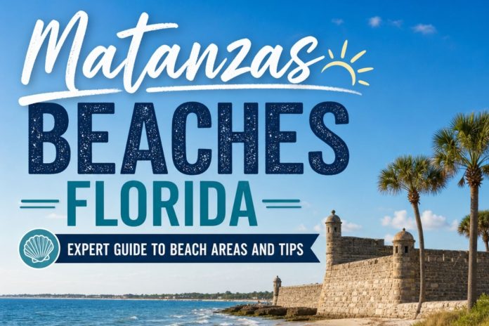
Matanzas Beaches, Florida
Matanzas Beaches is the quietest, wildest stretch of coast in this whole series of guides, and it’s also the one with the heaviest name. Matanzas is Spanish for slaughters, and the inlet earned that name in 1565, when Spanish forces executed more than 250 shipwrecked French soldiers on the very sand you’ll be walking. Almost five centuries later, this is still one of the most unstable, most naturally alive pieces of coastline in Florida, an inlet that reshapes itself with every storm and a barrier island community that’s been fighting the ocean for its own survival for decades.
This stretch runs south from Crescent Beach down through the Matanzas Inlet and the fragile community of Summer Haven, just before the coastline hands off to Marineland and the Flagler County line. There’s no boardwalk here, no pier, no strip of restaurants. What there is instead is a 280-year-old Spanish watch fort you can only reach by ferry, some of the best dolphin and shorebird watching on this entire coast, and a barrier island narrow enough in places that you can see the ocean and the river from the same spot.
In this guide I’m covering the ocean and river beaches at Fort Matanzas, the surf and fishing scene right at the inlet, and the strange, moving story of Summer Haven, a community that’s been quietly losing ground to the Atlantic for over a century. I’ll go deep on what makes this sand and water so different from the developed beaches just north of here, score it honestly across every category that matters, tell you exactly who this stretch fits and who should stick to St. Augustine Beach instead, and cover exactly where you can bring your dog. I close with my honest take on what a shifting inlet like this one actually teaches you about the coast.
The Vibe & Culture at Matanzas Beaches
A Coastline That Refuses to Sit Still
Most beaches in this guide look roughly the way they looked a decade ago. This one doesn’t, and that instability is the whole character of the place.
The Matanzas Inlet has no natural jetties holding it in place, which means its width, depth, and shape shift with every significant storm that passes through. Sandbars appear and vanish. The main channel wanders. In 2008, Tropical Storm Fay tore a brand-new breach through the barrier island south of the inlet, turning the Summer Haven River into a temporary extension of the Atlantic and cutting the community in half for a time. Locals here talk about hurricanes the way people elsewhere talk about seasons, as a recurring, expected part of how this coastline works, not an exception to it.
That instability has shaped the human history here just as much as the geology. In 1565, Spanish forces under Pedro Menéndez de Avilés executed a group of shipwrecked French Huguenots on this inlet’s sand after they surrendered, an event brutal enough that it gave the river, the inlet, and eventually the fort their permanent name. Nearly two centuries later, in 1740, Spain built Fort Matanzas out of local coquina specifically because this inlet was the one weak point in St. Augustine’s defenses, a back door wide enough for an enemy fleet to slip past the Castillo de San Marcos entirely.
Today, the human presence here is thin and deliberate. There’s no commercial strip, no chain hotel, nothing resembling a beach town. What you’ll find instead is a small National Park Service visitor center, a handful of surfers and anglers who know exactly which tide to show up on, and a community a few miles south, Summer Haven, that’s spent the better part of a century negotiating with an ocean that keeps taking a little more of it back. This is the beach corridor I recommend to people who’ve already done St. Augustine Beach and want to see what this coast looks like with almost nothing built on it.
Matanzas Beaches Areas: The Inlet, the Fort, and a Vanishing Shoreline
This stretch is short compared to the beach corridors further north, but what it lacks in mileage it makes up for in range, from a Spanish colonial fort to a barrier island community literally fighting to keep its ground. Here’s how I break it down.
Fort Matanzas Ocean Beach & Rattlesnake Island
8635 A1A South · Ferry Required for the Fort Itself
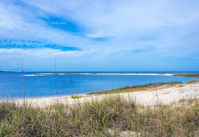
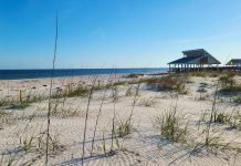
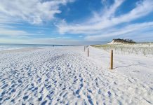
Park on the ocean side of A1A across from the Fort Matanzas visitor center and a boardwalk carries you over the dunes to a genuinely undeveloped stretch of Atlantic beach. At low tide, you’ll see exposed coquina rock and coral formations along this shoreline, a small, strange preview of the same shell-rock geology that built the fort itself. The beach here favors surfers and anglers who know the inlet’s rhythms, and it feels considerably wilder than anything at St. Augustine Beach a few miles north.
To actually reach the fort, you need a free ferry pass from the visitor center, first-come, first-served, no reservations, no phone holds. Passes typically run out by late morning, and the ferry itself doesn’t operate Tuesdays or Wednesdays. The ride out to Rattlesnake Island takes you across water where dolphins are a near-daily sight, and the fort’s tower, accessible by a narrow original staircase, gives you a compact, honest look at Spanish colonial military architecture without the crowds you’d find at the Castillo de San Marcos downtown.
The crowd here splits cleanly, a steady trickle of history-minded visitors heading for the ferry, and a smaller, more local group of surfers and fishermen who came for the inlet itself and have no interest in the fort at all. My honest take, get your ferry pass first thing, then spend your wait time on the beach boardwalk rather than sitting in the parking lot.
The River Side Beach & Salt Marsh
West Side of A1A · Calmer Water, Boardwalk Access
On the opposite side of A1A from the ocean beach, a short accessible boardwalk leads to a river-facing beach along the Matanzas River itself. This side swims differently than the ocean beach entirely, shallow, generally calmer, and considerably more forgiving for anyone nervous about open surf. The scenery here leans into salt marsh and maritime hammock rather than dunes, and it’s one of the better wildlife-watching spots in this whole stretch, with wading birds, osprey, and the occasional manatee working the shallows.
The crowd on this side is thinner and more deliberate, kayakers launching for a paddle, families who specifically want calm water for kids, and birders working the nature trail that winds through the hammock behind the parking area. It’s a genuinely peaceful counterpoint to the ocean side a short walk away.
My honest take, if you’re traveling with young kids or nervous swimmers, spend your beach time here instead of the ocean side. The current near the inlet mouth on the Atlantic side is genuinely dangerous, and this river beach gives you a real alternative without leaving the park.
The Inlet Surf & Drive-On Beach
North of the Bridge · Beach Driving, Serious Fishing
Just north of the bridge over Matanzas Inlet, a boardwalk crosses the dunes to a stretch favored by surfers and anglers working the inlet’s edge, where tidal flow through the channel creates some of the more consistent wave energy on this part of the coast. This is also a drive-on beach access point in season, though ramp availability shifts based on beach conditions and ongoing repair work, so it’s worth checking current status before you plan a trip around it.
The southern tip of Rattlesnake Island, visible from this stretch, is a well-known local fishing spot, and the inlet itself draws bottlenose dolphins hunting mullet regularly enough that watching for them becomes part of the experience without any effort on your part. Horseshoe crabs work the sandy bottom here too, a genuinely ancient sight if you know what you’re looking at.
My honest take, this is the stretch for anyone who wants real inlet energy, current, fish, and dolphins, without the crowd or infrastructure of a developed beach town. Respect the current here more than anywhere else in this guide. It’s not a swimming beach.
Summer Haven: A Community Negotiating With the Ocean
Old A1A South of the Inlet · A Different Kind of Beach Story
A few miles south of the fort, Summer Haven is unlike anywhere else in this guide. It’s a small, unincorporated community perched on a razor-thin strip of barrier island between the Atlantic and the Summer Haven River, and it’s been losing that fight, slowly and then suddenly, for well over a hundred years. The community traces back to the 1890s as a farmers’ vacation retreat, eventually drawing wealthy visitors including Thomas Mellon, Cornelius Vanderbilt Whitney, and author Marjorie Kinnan Rawlings, whose novel The Yearling remains one of the defining works of old Florida literature.
Storm after storm has reshaped this place. A 1962 nor’easter and 1964’s Hurricane Dora forced the Army Corps of Engineers to armor sections of the shoreline with granite revetment. A 2008 storm tore an entirely new breach through the island, briefly cutting Summer Haven into pieces. Since then, Hurricanes Matthew, Irma, Dorian, Ian, and Nicole have each taken their own bite, and St. Johns County has spent more than ten million dollars since 2008 trying to hold the line, with a full buyout of the most vulnerable homes now under serious, ongoing discussion.
There’s no beach amenity to speak of here, no restaurant, since the last one on the water was destroyed by Hurricane Matthew in 2016, and I’d stress that this remains a residential community, not a public attraction, so keep to public rights-of-way and treat the area with the same respect you’d want shown to your own street. What Summer Haven offers instead is a genuinely rare, sobering look at what it actually means to live on a barrier island in real time, not as an abstraction, but as a visible, ongoing negotiation between a handful of homes and an ocean that keeps changing its mind. I’ve written more about walking Old A1A through this area separately, since it deserves its own dedicated look.
Matanzas Beaches Rankings: Expert Scores Across 11 Categories
These scores weigh this corridor as the wild, undeveloped, historically dense stretch it actually is, which means it wins big on nature and history and loses ground on amenities and swimmable water.
Sand Quality
7/10
A quartz-and-coquina blend typical of this coast, with exposed coquina rock and coral visible at low tide near the fort, a genuinely unusual sight for a Florida beach.
Hiking & Beach Walking
7/10
Shorter beach stretches than further north, but the nature trails through maritime hammock and marsh add genuine walking variety you won’t find at a straight beach.
Shelling
7/10
Genuinely good, especially along the ocean beach at the fort, where shifting sandbars and inlet currents keep depositing fresh material.
Water Conditions
6/10
Genuinely dangerous current near the inlet mouth on the ocean side, balanced by calm, shallow, forgiving water on the river side. Know which beach you’re standing on before you swim.
Scenery & Natural Beauty
8/10
A genuinely wild inlet, salt marsh, and maritime hammock backdrop, with a 280-year-old fort adding a layer of history few beaches anywhere can match.
Birding & Wildlife
8/10
A stop on the Great Florida Birding Trail, with dolphins a near-daily sight in the inlet, osprey overhead, and sea turtles nesting on the ocean beach in season.
Family Friendliness
6/10
The ferry ride and fort tour are genuinely great for kids, and the calm river beach works well for younger children, but there are no food or restroom options beyond the visitor center.
Dog Friendliness
7/10
Leashed dogs are welcome on the beach and nature trail, though not on the ferry, in the visitor center, or at the fort itself.
Solitude & Peace
8/10
Genuinely quiet compared to any developed beach in this guide, though the inlet parking lots can fill and feel busy on a nice weekend by local standards.
Entertainment & Nightlife
2/10
There isn’t any. The last waterfront restaurant near the inlet was destroyed by Hurricane Matthew in 2016 and never rebuilt. Everything else is a drive north or south.
Parking & Beach Access
5/10
Limited lots that fill by mid-morning, no overflow parking, and ramp or access closures that shift with beach conditions and repair schedules.
Matanzas Beaches Sand & Water
The sand here changes character depending on where the inlet has been working lately, since this whole beach sits at the mouth of a river that keeps reshaping it. Near the fort you’ll find open, walkable stretches, but low tide also uncovers patches of exposed rock along parts of the shoreline, so this isn’t a beach built purely for lounging on a towel. There’s still plenty of flat, comfortable sand for a picnic or a slow walk, and sandcastles work fine on the softer stretches once you’ve added water, but keep shoes handy for the rockier zones near the inlet.
The water splits into two completely different personalities depending on which side of A1A you’re on. On the ocean side, right at the inlet mouth, the current runs genuinely strong, and this isn’t a spot for casual wading. Cross the road to the river side and you get a shallow, calm, kid-friendly alternative instead, with a gradual entry and none of the ocean side’s current. Know which side you’re on before you decide how deep to go.
-
Walkability. Comfortable and open near the fort, rockier and slower going right at the inlet, where sturdy footwear helps.
-
Softness & Playability. Soft enough for sandcastles on the open stretches, with patches of exposed rock at low tide that are more interesting to explore than to lie on.
-
Barefoot Comfort. Fine on the open sand, genuinely rough near the low-tide rock zones, so bring water shoes if you’re exploring the fort beach thoroughly.
-
Swimmability. Risky on the ocean side near the inlet, calm and family-friendly on the river side just across the road. Choose the river side if you’re at all unsure.
Want the full geology, grain composition, and the complete sand and water condition ratings? I broke it all down separately in Sand & Shore: Matanzas Beaches.
Dogs & Pet Accessibility at Matanzas Beaches
Are Dogs Allowed on the Sand? RESTRICTED.
Your leashed dog is welcome on the beach itself and along the nature trail, but not on the ferry, inside the visitor center, or at the fort. Plan your day around that split if seeing Fort Matanzas is part of your trip.
Where Dogs Are Allowed
- ✓The ocean beach near the fort, on a leash, including the boardwalk down to the sand.
- ✓The calmer river beach across A1A, a good spot to let your dog wade in shallow water.
- ✓The short nature trail through the maritime hammock near the visitor center.
Where Dogs Are NOT Allowed
- ✗The ferry to Rattlesnake Island, no pets permitted on board.
- ✗Inside the visitor center or the fort itself, both off-limits to pets.
Paws on the Ground Reality
Bring your own water for your dog, since there’s nothing to refill from once you’re past the visitor center, and the low-tide rock zones near the inlet are rough enough on paws that you’ll want to steer clear of them with a dog in tow. This is a genuinely quiet, uncrowded spot most days, so enforcement rarely feels like an issue, but the ferry and fort restrictions are consistently enforced since they’re staffed by rangers.
If your dog needs a longer walk than the beach alone offers, the nature trail near the visitor center and the quieter stretch of river beach both give you extra ground to cover without ever leaving the leash-friendly zones.
Crowd Levels and the Overall Feel of Matanzas Beaches
The crowd here concentrates at the fort’s parking lots and thins to almost nothing south of the inlet. Ferry visitors, surfers, and anglers make up most of the traffic at Fort Matanzas itself. Summer Haven, a few miles south, stays close to empty aside from the people who actually live there.
The overall feel shifts by season more around weather and storm risk than tourism:
- Spring: comfortable crowds, good fishing, and the calmest window before hurricane season swell arrives
- Summer: the busiest stretch at the fort, with ferry passes going fast and the inlet parking lots filling by mid-morning
- Fall: the most dynamic season here, with hurricane season directly shaping both the surf and, some years, the shoreline itself
- Winter: quiet, windy, and close to empty, the best season for uninterrupted birding and dolphin watching
Who Is Matanzas Beaches Really For?
✓ Who Will Love Matanzas Beaches
-
History lovers who want a genuine, uncrowded Spanish colonial fort experience rather than a downtown crowd
-
Anglers and surfers who know how to read an inlet and want some of the more dynamic water on this coast
-
Birders and wildlife watchers, given the dolphins, osprey, and sea turtle nesting concentrated in this small stretch
-
Anyone genuinely curious about coastal erosion and barrier island dynamics, since Summer Haven offers a rare, visible look at that story
-
Families who want a calm river beach and a ferry ride kids will remember, without needing a full beach-town infrastructure
-
Anyone who’s already covered St. Augustine Beach and wants to see this coast with almost nothing built on it
✗ Consider Another Beach If…
-
You want restaurants, restrooms, or any amenities directly at the beach. There’s essentially none here
-
You want to swim in open ocean water without real current risk. Stick to the river side here, or head to St. Augustine Beach instead
-
You’re arriving without a plan on a summer weekend. Parking lots here are small and fill fast with no overflow
-
You want guaranteed ferry access to the fort. Passes are first-come, first-served and often gone by late morning
-
You’re looking for nightlife or a beach town scene. This corridor has neither, on purpose
Things to Do at Matanzas Beaches, Florida
This is a small corridor, but it packs in more range than its size suggests.
-
Touring Fort Matanzas. A free ferry ride to Rattlesnake Island and a ranger-led tour of a 280-year-old Spanish coquina fort, with dolphins a common sight along the way.
-
Surfing. Consistent, current-driven waves near the inlet, best understood by locals who know the tide and channel conditions.
-
Fishing. The southern tip of Rattlesnake Island and the inlet’s edge are well-known local spots for redfish, sheepshead, and mullet-chasing dolphins.
-
Kayaking & Paddling. The calmer river side and the broader Matanzas River offer excellent flat-water paddling with genuinely good wildlife viewing.
-
Birding. A designated stop on the Great Florida Birding Trail, with osprey, wading birds, and migrating piping plovers all regularly reported. I go deeper on species and timing in my birding guide to Matanzas Beaches.
-
Nature Trails. Short boardwalk trails through maritime hammock and salt marsh near the visitor center, genuinely worth the walk even without beach time.
-
Shelling. Genuinely good along the ocean beach near the fort, where shifting sandbars keep turning up fresh material after storms. See my beach finds guide to Matanzas Beaches for specifics.
-
Wildlife Watching. Dolphins in the inlet, sea turtles nesting on the ocean beach in season, and horseshoe crabs working the shallows.
-
Driving Old A1A Through Summer Haven. A quiet, sobering drive through a community that’s spent decades negotiating with an eroding shoreline.
Local Knowledge and Practical Advice
A few things I’ve picked up covering this stretch more times than I can count:
-
Get your ferry pass early. Passes for Fort Matanzas are first-come, first-served, cannot be reserved by phone, and typically run out by mid to late morning.
-
Check the ferry schedule before you go. The ferry does not run on Tuesdays or Wednesdays, and trips can be cancelled for lightning or high wind.
-
Bring your own food and water. There are no restaurants or food vendors directly at the inlet, and the nearest options are a drive away.
-
Respect the current near the inlet mouth. It’s genuinely one of the stronger, more dangerous currents on this entire coast. Swim on the river side instead if you’re at all unsure.
-
Leashed dogs are welcome on the beach and trails, but not on the ferry or at the fort. Plan accordingly if you’re traveling with a pet and want to see the fort itself.
-
Bring bug spray for the nature trail. The maritime hammock behind the visitor center holds onto humidity, and mosquitoes are a genuine presence.
-
Check current beach driving and ramp status before planning around it. Access ramps here shift with beach conditions and repair schedules more than at any other beach in this guide.
-
Treat Summer Haven as a residential community, not an attraction. Stick to public roads and rights-of-way, and understand that the people who live there are dealing with a genuinely difficult, ongoing situation.
-
Respect sea turtle nesting season, May through October. Avoid flashlights on the beach at night and don’t disturb marked nests.
-
Watch the water on your ferry ride. Dolphins are a near-daily sight crossing to Rattlesnake Island, and most visitors don’t expect it.
Where to Stay Near Matanzas Beaches, Florida
This corridor has essentially no lodging of its own, which is part of what keeps it quiet. Here’s where to base yourself instead.
Crescent Beach, Just North
The closest real lodging option, with vacation rentals and a handful of local restaurants a short drive from the fort and inlet.
Summer Haven Vacation Rentals
A small number of vacation rentals exist in Summer Haven itself, though I’d go in with clear eyes about the area’s ongoing erosion challenges before booking directly on this stretch.
Camping at Anastasia State Park or Faver-Dykes State Park
Anastasia State Park, a longer drive north, offers beachfront camping in a maritime hammock. Faver-Dykes State Park, inland along Pellicer Creek, offers a quieter, non-beach camping alternative closer to this specific stretch.
Downtown St. Augustine, For Full Amenities
For restaurants, hotels, and a wider range of lodging, downtown St. Augustine sits a scenic 20 to 25 minute drive north along A1A.
What Makes Matanzas Beaches Different from Nearby Beaches
Matanzas Beaches stands apart because it’s shaped by an active inlet rather than settled, stable shoreline. Every other beach in this guide asks you to enjoy the coast as it currently is. This one shows you the coast actively becoming something else.
A few features make it distinct:
An inlet with no jetties
Matanzas Inlet reshapes itself with nearly every major storm, a rare, visible example of how Florida’s barrier islands would naturally behave without the stabilizing structures most developed inlets rely on.
A fort you can only reach by boat
Fort Matanzas’s ferry-only access keeps it genuinely uncrowded in a way no drive-up historic site can match, and the ride itself is part of the experience.
A community visibly negotiating with the ocean
Summer Haven offers a rare, sobering look at real-time coastal erosion and the human cost of living on a barrier island, a story no other beach in this guide tells as directly.
History with real weight
The 1565 massacre that gave this inlet its name adds a layer of gravity to this stretch of coast that goes beyond the usual Spanish colonial history found elsewhere in the region.
Matanzas Beaches vs. Other St. Johns County Beaches
These are the beaches visitors most often weigh against this corridor, and the honest read on when you’d choose one over the other.
Matanzas Beaches vs. Crescent Beach
Crescent Beach, just north, offers real amenities, easy parking, and a quiet old Florida feel without the inlet’s current risk. Choose Crescent Beach for a relaxed, easy beach day. Choose Matanzas for history and wildness.
Matanzas Beaches vs. Anastasia State Park
Anastasia offers a stable, four-mile beach with real infrastructure and a maritime hammock campground. Matanzas offers a shorter but more dynamic, historically dense stretch shaped by an active inlet.
Matanzas Beaches vs. St. Augustine Beach
St. Augustine Beach gives you amenities, surf culture, and nightlife within a short drive. Matanzas gives you almost none of that, trading it for genuine solitude and a working Spanish fort.
Matanzas Beaches vs. Marineland, Just South
Marineland trades this corridor’s undeveloped character for a specific, attraction-driven dolphin encounter experience. Both share the same wild, inlet-adjacent coastline character, just with very different things to do once you’re there.
Bottom line: Matanzas Beaches is the choice for history, wildlife, and a genuinely undeveloped stretch of Florida’s Atlantic coast. Crescent Beach and St. Augustine Beach give you more comfort and amenities. Matanzas gives you a fort, an inlet, and a coastline that’s still actively deciding what shape it wants to be.
Matanzas Beaches, Florida: Frequently Asked Questions
How do you get to Fort Matanzas?
By free ferry from the National Park Service visitor center at 8635 A1A South. Passes are first-come, first-served, and the ferry does not run on Tuesdays or Wednesdays.
Is there a fee for Fort Matanzas or the ferry?
No. Admission to the park, the fort, and the ferry ride are all free, though ferry passes are required and limited.
Can you swim at Matanzas Inlet?
Swim with real caution on the ocean side, where current near the inlet mouth runs genuinely strong. The river side beach across A1A is calmer and better suited for families.
Are dogs allowed at Fort Matanzas beach?
Yes, leashed dogs are welcome on the beach and nature trail, but not on the ferry, in the visitor center, or at the fort itself.
Can you drive on the beach at Matanzas Inlet?
In some seasons and locations, yes, though ramp access shifts with beach conditions and repair schedules more than at other St. Johns County beaches. Check current status before planning around it.
What happened to Summer Haven?
This small barrier island community has faced ongoing beach erosion for decades, worsened by repeated hurricanes and nor’easters. St. Johns County has spent over ten million dollars on mitigation since 2008, with a buyout of the most vulnerable homes now under serious discussion.
Is Matanzas Beach good for shelling?
Yes, genuinely good, especially along the ocean beach near the fort, where shifting sandbars and inlet currents regularly deposit fresh shell material.
What is Rattlesnake Island?
The barrier island where Fort Matanzas sits, reachable only by the National Park Service ferry. It’s also a popular local fishing spot at its southern tip.
Is Matanzas Beach crowded?
Rarely. The fort’s parking lots can fill on nice weekends, but this corridor stays significantly quieter than St. Augustine Beach or Crescent Beach year-round.
What does “Matanzas” mean and why is it called that?
Matanzas is Spanish for slaughters. The name commemorates the 1565 execution of more than 250 shipwrecked French soldiers by Spanish forces at this inlet.
Patti’s Perspective: My Honest Take on Matanzas Beaches
Summer Haven is the part of this guide I’ve thought about longest after finishing it. Driving Old A1A slowly, past homes that have been rebuilt, sandbagged, and rebuilt again, past docks that no longer reach water and stilted houses thirty feet from the high tide line, I understood something about the cost of loving a piece of coastline that no brochure ever tells you. These are people who’ve chosen, deliberately and repeatedly, to keep living somewhere the ocean keeps trying to take back. I don’t know if that’s stubbornness or devotion. I suspect it’s both.
My honest caveat, don’t come here expecting a typical beach day. Come here expecting a fort, an inlet, and a genuine, unresolved story about what it costs to live on a barrier island. Give it the respect and the time that story deserves, and this becomes one of the more quietly powerful stops in this entire guide.
Want to Live by the Water?The Matanzas corridor, including Summer Haven and the quieter stretches near Crescent Beach, offers some of the most genuinely rural, low-density coastal real estate left in St. Johns County, though it comes with real and well-documented erosion considerations worth understanding before you buy.The market here draws buyers looking for a genuinely quiet, undeveloped stretch of coast, along with investors and county planners navigating the area’s ongoing coastal resilience challenges. Nearby Crescent Beach offers a steadier, more traditional alternative for anyone drawn to this part of the coast without the same shoreline risk.If living near this kind of dynamic, historically rich coastline is something you’re considering, it’s worth exploring what’s available in this area, and understanding the erosion history first.Explore Waterfront Living at LiveByTheWater.com
Real estate referral partner